Ceredigion Coast Path
Coast of CeredigionCoastal paths in WalesGeographic coordinate listsLists of coordinatesLong-distance footpaths in Wales ... and 3 more
Recreational walks in WalesTourist attractions in CeredigionUse British English from April 2017

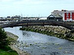
The Ceredigion Coast Path (Welsh: Llwybr Arfordir Ceredigion) is a waymarked long distance footpath in the United Kingdom, on the coast of Ceredigion, Wales. It is 65 miles (105 km) in length, running along the coast of Cardigan Bay from Cardigan (52.0810°N 4.6608°W / 52.0810; -4.6608 (Ceredigion Coast Path, southern end)) to Ynyslas (52.5271°N 4.0495°W / 52.5271; -4.0495 (Ceredigion Coast Path, northern end)). The path forms one section of the Wales Coast Path, an 870-mile (1,400 km) long-distance walking route around the whole coast of Wales from Chepstow to Queensferry, opened in 2012.
Excerpt from the Wikipedia article Ceredigion Coast Path (License: CC BY-SA 3.0, Authors, Images).Ceredigion Coast Path
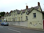
Victoria Street,
Geographical coordinates (GPS) Address Nearby Places Show on map
Geographical coordinates (GPS)
| Latitude | Longitude |
|---|---|
| N 52.2477 ° | E -4.2557 ° |
Address
Victoria Street
SA46 0AU , Aberaeron
Wales, United Kingdom
Open on Google Maps


