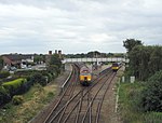
Hapsford
Cheshire West and ChesterCheshire geography stubsFormer civil parishes in CheshireVillages in Cheshire

Hapsford is a village and former civil parish, now in the parish of Dunham-on-the-Hill and Hapsford, in the unitary authority area of Cheshire West and Chester and the ceremonial county of Cheshire, England. It is located on the A5117 road, with Helsby to the east and the village of Elton, near Ellesmere Port, to the north west. Junction 14 of the M56 motorway and Chester services motorway service station are sited nearby. At the 2001 Census the population of Hapsford civil parish was recorded as 129, increasing slightly to 133 at the 2011 census.
Excerpt from the Wikipedia article Hapsford (License: CC BY-SA 3.0, Authors, Images).Hapsford
Moor Lane,
Geographical coordinates (GPS) Address Nearby Places Show on map
Geographical coordinates (GPS)
| Latitude | Longitude |
|---|---|
| N 53.264 ° | E -2.791 ° |
Address
Moor Lane
Moor Lane
WA6 0JT , Dunham-on-the-Hill and Hapsford
England, United Kingdom
Open on Google Maps


