place

Dunham Hill railway station

Disused railway stations in CheshireFormer Birkenhead Railway stationsNorth West England railway station stubsPages with no open date in Infobox stationRailway stations in Great Britain closed in 1952
Railway stations in Great Britain opened in 1850Use British English from March 2018
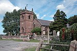
Site of Dunham Hill station geograph 3316171 by Ben Brooksbank

Dunham Hill railway station was a railway station in Dunham-on-the-Hill, Cheshire. It was opened in 1850 and closed in 1952. Near to the station was a branch line leading to the former ROF Dunham on the Hill explosives storage depot. The station buildings were demolished after closure but the platforms remained until the 1970s.

Excerpt from the Wikipedia article Dunham Hill railway station (License: CC BY-SA 3.0, Authors, Images).

Dunham Hill railway station
Hob Lane,

Geographical coordinates (GPS) Address Nearby Places
placeShow on map

Wikipedia: Dunham Hill railway stationContinue reading on Wikipedia

Geographical coordinates (GPS)

Latitude Longitude
N 53.2488 ° E -2.7994 °
placeShow on map

Address

Hob Lane
WA6 0LW , Dunham-on-the-Hill and Hapsford
England, United Kingdom
mapOpen on Google Maps

Site of Dunham Hill station geograph 3316171 by Ben Brooksbank
Share experience

Nearby Places

Barrow for Tarvin railway station

Barrow for Tarvin railway station was in Barrow, Cheshire, England. The station was opened by the Cheshire Lines Committee on 1 May 1875 as Tarvin & Barrow, but renamed in 1883 to better reflect its location (the village of Tarvin being more than 2 miles (3.2 km) away). A goods shed and sidings were provided to the west of the passenger depot, which was provided with standard CLC main buildings on the Manchester-bound side and a brick shelter on the Chester-bound platform. The sidings were worked from a signal box on the up (northbound) platform. By 1895, seven southbound (Down) and six northbound (up) trains called here each weekday, with one additional call each way on a Saturday and three each way on Sundays. This service pattern remained broadly unchanged after the 1923 Grouping, but had improved to nine up and eleven down trains by 1949. However, it was subsequently closed by the British Transport Commission on 1 June 1953, due to low usage. Goods traffic ceased at the same time, with the signal box being closed the following year and the remaining facilities removed by 1958. The line through the station site was subsequently reduced to single track in September 1969, prior to the closure of the former CLC Chester Northgate terminus and the diversion of traffic to Chester (General) the following month. The station building here still survives (though derelict) and is visible from passing trains, having been sold for use as private residence.

St. Plegmund's well
St. Plegmund's well

St. Plegmund's well lies about 220 yards (201 m) to the west of St Peter's Church, Plemstall near the village of Mickle Trafford, Cheshire, England (grid reference SJ454701). It is named after Plegmund, who later became Archbishop of Canterbury, and who is believed to have lived as a hermit nearby. The well is situated on the edge of a low cliff to the east of which is one of the channels of the River Gowy. It is one of two holy wells in west Cheshire. An inscribed sandstone curb was added in 1907 which was dedicated by the Venerable E. Barber, Archdeacon of Chester, on 11 November 1907. The earliest documentary evidence of the well is in a quitclaim dated 1301.A survey of the well was carried out in 1995 which found that it is a square stone-lined pit with two large slabs on either side and two steps down from the southern side beside the road. In the bottom of the well is a ceramic pipe which has been inserted at a later date. At the time of the survey there was water present up to the level of the first step. The cover slabs show some signs of damage but there was no sign of the curbs added in 1907. It is said to have been used for baptisms up to the 20th century. In the 1990s, it was noticed that the hawthorn tree overhanging the well was dressed periodically and during the later 1990s, archaeologists from Chester City Council led local children on a well dressing walk on St Plegmund's feast day (2 August). This continued until 2000, when a more formal annual well dressing event was revived. The well is a scheduled monument.