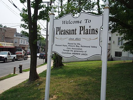
Pleasant Plains, Staten Island

Pleasant Plains is a neighborhood located on Staten Island, New York City, New York. It is bordered by Woodrow to the north, the Lower New York Bay to the south, Richmond Valley to the west, and Prince's Bay to the east. The neighborhood is represented in the New York City Council by Joe Borelli. Situated on the island's South Shore, Pleasant Plains has a population of 5,000 according to the 2000 census. It was named by officials of the Staten Island Railroad Corporation, the original owners of what is now known as the MTA Staten Island Railway. When the railroad line was extended to Tottenville in 1860, a station crossing Amboy Road approximately two miles north of Tottenville was named Pleasant Plains. Eventually, the name "Pleasant Plains" was applied to the community which soon sprung up around the station.
Excerpt from the Wikipedia article Pleasant Plains, Staten Island (License: CC BY-SA 3.0, Authors, Images).Pleasant Plains, Staten Island
Amboy Road, New York Staten Island
Geographical coordinates (GPS) Address Nearby Places Show on map
Geographical coordinates (GPS)
| Latitude | Longitude |
|---|---|
| N 40.523888888889 ° | E -74.215555555556 ° |
Address
Amboy Road
10309 New York, Staten Island
New York, United States
Open on Google Maps


