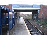
Cauldwell, Bedford
Areas of Bedford

Cauldwell is an electoral ward and area within the town of Bedford, England. The boundaries of Cauldwell are approximately Rope Walk to the north, Redwood Grove and Willow Road to the east, with the Midland Main Line railway line to the south. The area is sometimes known as St John's.
Excerpt from the Wikipedia article Cauldwell, Bedford (License: CC BY-SA 3.0, Authors, Images).Cauldwell, Bedford
Haynes Road,
Geographical coordinates (GPS) Address Nearby Places Show on map
Geographical coordinates (GPS)
| Latitude | Longitude |
|---|---|
| N 52.12393 ° | E -0.46726 ° |
Address
Haynes Road
Haynes Road
MK42 9PG , Cauldwell
England, United Kingdom
Open on Google Maps


