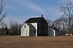
Stump Pond (Pembroke, Massachusetts)
Lakes of Plymouth County, MassachusettsPembroke, MassachusettsPlymouth County, Massachusetts geography stubsReservoirs in Massachusetts

Stump Pond, also known as Reservoir MA 94127, was a 113-acre (0.46 km2) reservoir in Pembroke, Massachusetts in the East Pembroke section of the town, east of the northern end of the Routes 14 and 53, west of Keene Pond and southwest of Arnold School Pond. Today, the area is part of the Burrage Pond Wildlife Management Area.
Excerpt from the Wikipedia article Stump Pond (Pembroke, Massachusetts) (License: CC BY-SA 3.0, Authors, Images).Stump Pond (Pembroke, Massachusetts)
Edgewater Drive,
Geographical coordinates (GPS) Address Nearby Places Show on map
Geographical coordinates (GPS)
| Latitude | Longitude |
|---|---|
| N 42.081944444444 ° | E -70.773055555556 ° |
Address
Edgewater Drive 147
02359
Massachusetts, United States
Open on Google Maps


