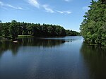
Mary's Pond
Plymouth County, Massachusetts geography stubsPonds of MassachusettsPonds of Plymouth County, MassachusettsRochester, Massachusetts
Mary's Pond, also known as Marys Pond, is an 81-acre (330,000 m2) kettle pond in Rochester, Massachusetts. The pond is located east of Leonards Pond. The average depth is 12 feet (3.7 m), and the maximum depth is 32 feet (9.8 m). Rochester's town beach is located on the northwestern shore of the pond along Mary's Pond Road. In 2011, amid plans to create a recreation area on the popular beach, a title search revealed that the beach was privately owned. Although the town of Rochester maintains Mary's Pond Road through an easement, and although the State of Massachusetts maintains the pond itself, the beach is now closed to the public.
Excerpt from the Wikipedia article Mary's Pond (License: CC BY-SA 3.0, Authors).Mary's Pond
Perrys Lane,
Geographical coordinates (GPS) Address Nearby Places Show on map
Geographical coordinates (GPS)
| Latitude | Longitude |
|---|---|
| N 41.755555555556 ° | E -70.791666666667 ° |
Address
Marys Pond Recreation Area
Perrys Lane
02770
Massachusetts, United States
Open on Google Maps


