place

Penton Hook Lock

Locks on the River ThamesUse British English from January 2017
PentonHLock
PentonHLock

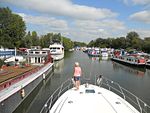
Penton Hook Lock is the sixth lowest lock of forty four on the non-tidal reaches of the River Thames in England. It faces an island which was until its construction a pronounced meander (a hook) and is on the site of its seasonal cutoff. It is against the left bank marking the church parish medieval border of Laleham and Staines upon Thames in Surrey for many centuries. Until 1965 their county was Middlesex. At 266 ft (81 m) it is the third longest lock on the river. A bend 1000 yards (900 metres) upstream of the lock, Silvery Sands, hosts Staines Regatta in the sport of rowing annually. On the opposite bank in Thorpe is Penton Hook Marina which occupies lakes once land used for gravel extraction.

Excerpt from the Wikipedia article Penton Hook Lock (License: CC BY-SA 3.0, Authors, Images).

Penton Hook Lock
Thames Side,

Geographical coordinates (GPS) Address Nearby Places
placeShow on map

Wikipedia: Penton Hook LockContinue reading on Wikipedia

Geographical coordinates (GPS)

Latitude Longitude
N 51.414722222222 ° E -0.50027777777778 °
placeShow on map

Address

Thames Side

Thames Side
KT16 8RS
England, United Kingdom
mapOpen on Google Maps

PentonHLock
PentonHLock
Share experience

Nearby Places

Laleham Burway
Laleham Burway

Laleham Burway is a 1.6-square-kilometre (0.62 sq mi) tract of water-meadow and former water-meadow between the River Thames and Abbey River in the far north of Chertsey in Surrey. Its uses are varied. Part is Laleham Golf Club. Semi-permanent park homes in the west forms residential development along with a brief row of houses with gardens against the Thames. A reservoir and water works is on the island. From at least the year 1278 its historic bulky northern definition formed part of the dominant estate of Laleham across the river, its manor, to which it was linked by a ferry until the early 20th century. Its owner in period from the mid-19th until the early 20th century was thus the Earl of Lucan; however when its manor house was sold to become Laleham Abbey, a short-lived nunnery, its tenants had taken it over or it was sold for public works. The southern part of the effective island sharing the name of the Burway or Laleham Burway was the Abbey Mead. It was kept since the seventh century among many square miles of land, priories, chantries, tithes (rectories) and churches of Chertsey Abbey until the Dissolution of the Monasteries. The part legally separate from Abbey Mead (being together a large mill-race island with a broad corollary of the river beside them), the narrower definition comprised 200 acres (81 ha). In 1911 these remained largely for horse and cow pasture. Part of it was a cricket venue in the 18th century and the home of Chertsey Cricket Club.