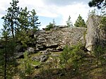
Dishman Hills Natural Resources Conservation Area is a 530-acre (210 ha) area protected by a combination of public and non-profit groups (Spokane County Parks and Recreation Department, Washington Department of Natural Resources, Inland Northwest Land Conservancy, and Dishman Hills Conservancy), located in Spokane County, Washington. The granite outcroppings, forming the bulk of the area, were originally formed 70 million years ago, by volcanic magma pushing up through the Earth's crust and then cooling. The protected Dishman Hills Natural Resources Conservation Area with its rugged, potholed appearance and deep gullies is a result of the Missoula Floods and represents one of the most ecologically diverse regions in Washington state, where forests, grasslands and shrublands converge and is within two ecoregions, the Okanagan and Northern Rockies ecoregions. The hills consist of small ravines, ponds, and large chunks of granite, that support an eco-system consisting mainly of ponderosa pine, as well as about 300 different flowering plants (including Indian Camas), and 73 different species of mushrooms. The area also supports wildlife, such as coyotes, marmots, white-tailed deer, pheasants, and dozens of species of butterflies. The Dishman Hills rise immediately south of the Dishman section of The City of Spokane Valley. Continuing south, out of the park, the elevation continues to rise to the Rocks of Sharon and the Iller Creek Conservation Area near the peak of Krell Hill.


