place

North Cray

Areas of LondonDistricts of the London Borough of BexleyFormer civil parishes in LondonFormer civil parishes in the London Borough of BexleyFormer civil parishes in the London Borough of Bromley
London geography stubsSidcupUse British English from September 2015
North Cray Road
North Cray Road

North Cray is a village in south-east London, England, within the London Borough of Bexley. It is 12.6 miles (20.3 km) south-east of Charing Cross. It lies on the River Cray, east of Sidcup and south of Bexley, and is in the Cray Meadows electoral ward, which also includes Foots Cray.

Excerpt from the Wikipedia article North Cray (License: CC BY-SA 3.0, Authors, Images).

North Cray
North Cray Road, London North Cray (London Borough of Bexley)

Geographical coordinates (GPS) Address Nearby Places
placeShow on map

Wikipedia: North CrayContinue reading on Wikipedia

Geographical coordinates (GPS)

Latitude Longitude
N 51.424 ° E 0.135 °
placeShow on map

Address

Weatherley Fencing

North Cray Road
DA14 5EL London, North Cray (London Borough of Bexley)
England, United Kingdom
mapOpen on Google Maps

North Cray Road
North Cray Road
Share experience

Nearby Places

Hundred of Ruxley
Hundred of Ruxley

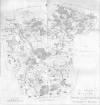
Ruxley (previously Rokesley, and in the Domesday Book Helmestrei) was an ancient hundred, a land division in the north west of the county of Kent, England. Its area has been mostly absorbed by the growth of London; with its name currently referring to the Ruxley district. Its former area now corresponds to a majority of the London Borough of Bromley, a large part of the London Borough of Bexley and a small part of the Kent District of Sevenoaks. The hundred was within the Lathe of Sutton-at-Hone, in the west division of Kent. The hundred was approximately fourteen miles (22.5 km) at its longest north to south and about eight miles (13 km) and its widest east to west. The River Cray was the largest river in the hundred of Ruxley flowing northward through six of its parishes, four of which are named after it. The River Cray rises in Orpington then flows through St Mary Cray, St Paul's Cray, North Cray, Foots Cray, and Bexley before crossing the northern border and Watling Street into the Hundred of Lesnes. In 1797 the hundred was recorded as being divided into two half hundreds named Upper Ruxley and Lower Ruxley and under the jurisdiction of two constables.As almost all the area of the Ruxley hundred has now been absorbed by the growth of London, and as civil parishes were abolished in Greater London, Knockholt which was in the south of Ruxley is the only parish of the Hundred that is a civil parish today. Knockholt is also the only part of this Kent Hundred that is in Kent today, although both would not have been true whilst Knockholt was in the London Borough of Bromley between 1965 and 1969.