place

Mount Crawford, Virginia

Towns in Rockingham County, VirginiaTowns in VirginiaUse mdy dates from July 2023
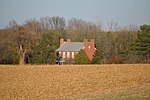
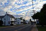
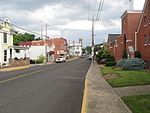
Houses in Mount Crawford, Virginia

Mount Crawford is a town in Rockingham County, Virginia, United States. It is included in the Harrisonburg Metropolitan Statistical Area, and the town's population was 433 at the 2010 census.

Excerpt from the Wikipedia article Mount Crawford, Virginia (License: CC BY-SA 3.0, Authors, Images).

Mount Crawford, Virginia
North Main Street,

Geographical coordinates (GPS) Address Phone number Nearby Places
placeShow on map

Wikipedia: Mount Crawford, VirginiaContinue reading on Wikipedia

Geographical coordinates (GPS)

Latitude Longitude
N 38.356944444444 ° E -78.941944444444 °
placeShow on map

Address

Mount Crawford Post Office

North Main Street 411
22841
Virginia, United States
mapOpen on Google Maps

Phone number

call+15405744436

Houses in Mount Crawford, Virginia
Share experience

Nearby Places

North River (South Fork Shenandoah River tributary)

The North River is a 55.3-mile-long (89.0 km) river in the mountains and Shenandoah Valley of northern Virginia, the United States. It joins the South River at Port Republic to form the South Fork Shenandoah River. The river rises at 4,000 feet (1,200 m) above sea level in western Augusta County, below Dyers Knob on Shenandoah Mountain along the Virginia-West Virginia border. From the man-made Elkhorn Lake it flows south and then east through the George Washington National Forest. The river breaks out of the Allegheny Mountains at North River Gap and flows into the broad Valley of Virginia. The river passes through the town of Bridgewater and flows southeast, joining the South River at Port Republic. The Middle River, a major tributary, joins the North River just west of the town of Grottoes, four miles above the juncture with the South River. Other towns along the river include Mount Solon, Stokesville, Sangersville, Natural Chimneys, Mount Crawford, and the village of North River. The river is popular among canoeists, rafters and inner tubers. At one point during the 19th century barges shipped goods upstream via a canal/lock system. Typical wildlife of the North River includes the great blue heron, wood duck, Canada goose, belted kingfisher, Baltimore oriole, painted turtle, common snapping turtle, largemouth bass, sun perch, catfish, eastern cottontail rabbit, white-tailed deer, raccoon, opossum, brown bats, freshwater clams, mink, tiger swallowtail and ebony jewelwing. Typical plant life of the North River includes the cardinal flower, joe-pye weed, purple monkeyflower, great blue lobelia, bulrush, yellow iris, American sycamore, cottonwood, box-elder, silver maple, Virginia bluebells, and spring beauty.

Daniel Harrison House

Daniel Harrison House, also known as Fort Harrison, is a historic home located near Dayton, Rockingham County, Virginia. The original structure was built in 1748 as a two-story, three bay limestone dwelling, with a steep gable roof and wide chimney caps. A brick extension was added in the early 1800s. It was originally surrounded by a palisade and was reported to have an underground passage to the nearby spring. During the French and Indian War, the legislature of Virginia designated the house and surrounding property "Fort Harrison." The house is one of the oldest in the Shenandoah Valley, and is closely associated with the early history of Rockingham County.The home's original owner, Captain Daniel Harrison, was one of the first to use the plentiful supply of limestone for building. His stone house is referred to in one of his first deeds, dated February 28, 1749, in Rockingham County Deed Book 2, p. 586 - "Daniel Harrison, Gent. to Arthur Johnson, 190 acres; 10 acres; Cook's Creek–Harrison's stonehouse". In 1745, Captain Harrison was appointed by the Court of Orange County, along with brother John and Robert Cravens, as overseer to lay out and clear the old Indian Road – "The Long Grey Trail" – through what is now Rockingham County. This was destined to be the most traveled highway in the Shenandoah Valley. In 1751, Capt. Harrison became Under Sheriff of Augusta CountyThe site was listed on the National Register of Historic Places in 1973.Fort Harrison is open to the public on Friday and Saturday in the summer and by appointment.