place

Washington High School (Oregon)

1906 establishments in Oregon1981 disestablishments in OregonAC with 0 elementsBuckman, Portland, OregonDefunct schools in Oregon
High schools in Portland, OregonNational Register of Historic Places in Portland, OregonPortland Public Schools (Oregon)School buildings completed in 1907School buildings completed in 1924School buildings on the National Register of Historic Places in OregonUse mdy dates from April 2012
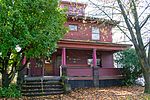
Former Washington HS (Portland, Oregon) in 2013 entablature showing school name

Washington High School was a high school in Portland, Oregon, United States, from 1906 to 1981. After fire destroyed the original building, a new building was completed in 1924. The school merged with Monroe High School in 1978 to become Washington-Monroe High School. The school closed shortly after in 1981. A few years later it was used as the Children's Services Center, a mulitpuropose social service facility that also provided day care and other programs for at risk youth. After that the building was vacant for many years. It was also used for a time as a location for administrative offices for the Portland Public Schools. During a brief time around 2005, Washington High School was used as a temporary site for the relocation of some of the newly arrived survivors from Hurricane Katrina. In 2009, it was used as the site for the Portland Institute for Contemporary Art's Time-Based Arts Festival or TBA. In October 2013, plans to renovate the building for commercial use were advancing, with a mix of retail and office use planned. New Seasons Market relocated its offices to the building in 2015 and is the largest tenant. The former auditorium was repurposed as a music venue called Revolution Hall, which opened in February 2015. The building was listed on the National Register of Historic Places in November 2015.

Excerpt from the Wikipedia article Washington High School (Oregon) (License: CC BY-SA 3.0, Authors, Images).

Washington High School (Oregon)
Southeast Stark Street, Portland Buckman

Geographical coordinates (GPS) Address Website External links Nearby Places
placeShow on map

Wikipedia: Washington High School (Oregon)Continue reading on Wikipedia

Geographical coordinates (GPS)

Latitude Longitude
N 45.518972222222 ° E -122.652 °
placeShow on map

Address

Washington High School

Southeast Stark Street 1300
97214 Portland, Buckman
Oregon, United States
mapOpen on Google Maps

Website
washingtonhighschoolpdx.com

linkVisit website

linkWikiData (Q7971921)
linkOpenStreetMap (142986239)

Former Washington HS (Portland, Oregon) in 2013 entablature showing school name
Share experience

Nearby Places

Buckman, Portland, Oregon

Buckman is a neighborhood in the Southeast section (and a small portion of the Northeast section) of Portland, Oregon. The neighborhood is bounded by the Willamette River on the west, E Burnside St. on the north (except for a triangle between NE 12th Ave. and NE 14th Ave. in which NE Sandy Blvd. forms the northern border), SE 28th Ave. on the east, and SE Hawthorne Blvd. on the south. Schools in the neighborhood include Buckman Arts Magnet Elementary School (part of Portland Public Schools) and Central Catholic High School. The neighborhood is named for late 19th century orchardist, and school board and city council member, Cyrus Buckman. In the 19th Century the neighborhood was the center of the City of East Portland before it merged with the City of Portland on the west bank of the Willamette River. Today, the historic center of East Portland is designated as the East Portland Grand Avenue Historic District. The former Washington High School, built in 1924, is also in Buckman. Buckman is home to Ota Tofu Company, which has been described as the oldest existing tofu shop in the United States. Three bridges connect Buckman to neighborhoods in Southwest Portland across the Willamette: the Old Town Chinatown neighborhood via the Burnside Bridge, and Downtown Portland via the Morrison and Hawthorne Bridges. Two retail districts lie partially within Buckman: the Belmont District and the Hawthorne District. The neighborhood also includes Lone Fir Cemetery (1855), Colonel Summers Park (1921), Buckman Community Garden (1980), and much of the Vera Katz Eastbank Esplanade (opened 2001).