place

Rivière du Tombeau

Mauritius geography stubsRivers of Mauritius

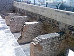
Rivière du Tombeau is a river in northwestern Mauritius. Its source is on the slopes of Pieter Both Mountain, from where it flows north and then west for a total of 16 kilometres, reaching the Indian Ocean at Baie-du-Tombeau, north of the capital of Port Louis.

Excerpt from the Wikipedia article Rivière du Tombeau (License: CC BY-SA 3.0, Authors).

Rivière du Tombeau
Royal Park Avenue,

Geographical coordinates (GPS) Address Nearby Places
placeShow on map

Wikipedia: Rivière du TombeauContinue reading on Wikipedia

Geographical coordinates (GPS)

Latitude Longitude
N -20.1 ° E 57.516666666667 °
placeShow on map

Address

Hotel Angsana

Royal Park Avenue
21733
Pamplemousses, Mauritius
mapOpen on Google Maps

Share experience

Nearby Places

Trou-aux-Biches
Trou-aux-Biches

Trou-aux-Biches is a small town with a public beach on the northern coast of the island Mauritius in the district of Pamplemousses. According to the World Travel group, the beach is one of the most beautiful on the island. They awarded it the World's Leading Beach Destination at the World Travel Award for 2011. Many tourist resorts and boutique hotels are situated near the beach, such as the Trou aux Biches Resort & Spa. From Port Louis, the M2 highway heads towards it, with Trou-aux-Biches about a mile west from the end of M2. The airport and the town are connected by a public bus. Trou-aux-Biches started off as a fishing village in the 19th century, and its name appears on the Lislet-Geoffroy map drawn in 1807 during the French colonial rule of the island. In recent time, it has evolved into a small town with a two kilometer long white sand beach shaded by casuarina trees, snorkeling reefs, boutique shops, a supermarket and other facilities along the B38 road catering to family tourism.While tourism began in Mauritius in 1952 with the construction of a small hotel in Curepipe for air crews arriving in colonial Mauritius, the first major hotel was built in Trou-aux-Biches in 1971 after Mauritius gained independence in 1968. The town retains its village style and is less commercialized than nearby Grand Baie. Inland from the town is Maheswarnath Mandir, the island's largest Hindu temple, founded in 1888.The beach at Trou-aux-Biches is popular for sunset watching.

Aapravasi Ghat
Aapravasi Ghat

The Immigration Depot (Hindi: आप्रवासी घाट, ISO: Āpravāsī Ghāta) is a building complex located in Port Louis on the Indian Ocean island of Mauritius, the first British colony to receive indentured, or contracted, labour workforce from many countries. From 1849 to 1923, half a million Indian indentured labourers passed through the Immigration Depot, to be transported to plantations throughout the British Empire. The large-scale migration of the labourers left an indelible mark on the societies of many former British colonies, with Indians constituting a substantial proportion of their national populations. In Mauritius alone, 68 percent of the current total population is of Indian ancestry. The Immigration Depot has thus become an important reference point in the history and cultural identity of Mauritius. Unchecked infrastructural development in the mid-20th century means that only the partial remains of three stone buildings from the entire complex have survived. These are now protected as a national monument, under the Mauritian national heritage legislation. The Immigration Depot's role in social history was recognized by UNESCO when it was declared a World Heritage Site in 2006. The site is under the management of the Aapravasi Ghat Trust Fund. Conservation efforts are underway to restore the fragile buildings to their 1860s state. It is one of two World Heritage Sites in Mauritius, along with Le Morne Brabant.