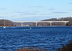
Fort Shantok

Fort Shantok, in Montville, Connecticut, was the site of the principal Mohegan settlement between 1636 and 1682 and the sacred ground of Uncas, one of the most prominent and influential Mohegan leaders and statesmen of his era. Originally part of Mohegan reservation lands, the property was taken by the state of Connecticut in the 20th century and Fort Shantok State Park was established. In 1995, following legal action by the tribe to recover its lands, the state returned the park to Mohegan control. The tribe now operates the area, part of its reservation, as a local park. The grounds were declared a National Historic Landmark (as the Fort Shantok Archaeological District) in 1993.
Excerpt from the Wikipedia article Fort Shantok (License: CC BY-SA 3.0, Authors, Images).Fort Shantok
Massapeag Side Road,
Geographical coordinates (GPS) Address Nearby Places Show on map
Geographical coordinates (GPS)
| Latitude | Longitude |
|---|---|
| N 41.4778 ° | E -72.0778 ° |
Address
Massapeag Side Road
Massapeag Side Road
06335
Connecticut, United States
Open on Google Maps


