Sandy Lane, West Yorkshire
Civil parishes in West YorkshireGeography of the City of BradfordUse British English from January 2018Villages in West YorkshireWest Yorkshire geography stubs

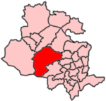
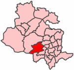
Sandy Lane is a village and civil parish to the north of Bradford, West Yorkshire, England. The population of the civil parish as of the 2011 census was 2,646.It is situated between Wilsden, Allerton and Nab Wood.
Excerpt from the Wikipedia article Sandy Lane, West Yorkshire (License: CC BY-SA 3.0, Authors, Images).Sandy Lane, West Yorkshire
Prune Park Lane, Bradford
Geographical coordinates (GPS) Address Nearby Places Show on map
Geographical coordinates (GPS)
| Latitude | Longitude |
|---|---|
| N 53.81 ° | E -1.84 ° |
Address
Prune Park Lane
Prune Park Lane
BD15 9BJ Bradford
England, United Kingdom
Open on Google Maps


