place

RAF Ventnor

EngvarB from May 2019History of the Isle of WightRoyal Air Force stations in HampshireVentnor
Royal Air Force Radar, 1939 1945 CH15174

Royal Air Force Ventnor or more simply RAF Ventnor is a former Royal Air Force radar station located 0.7 miles (1.1 km) north east of Ventnor on the Isle of Wight, England. It was initially constructed in 1937 as part of a World War II coastal defence programme codenamed Chain Home. The site played an important role during the Second World War, providing early warnings of incoming bomber attacks carried out by the Luftwaffe. The site was also part of the ROTOR programme in the 1950s as a Centimetric Early Warning (CEM) station, keeping a constant watch for suspicious Soviet bombers. During the time, an extensive bunker complex was also built at the site, which would later be converted for use as a shelter in case of a nuclear strike during the Cold War. Most of the buildings and facilities at the site have since been demolished, with the bunkers now sealed shut following unauthorised access.

Excerpt from the Wikipedia article RAF Ventnor (License: CC BY-SA 3.0, Authors, Images).

RAF Ventnor
Bonchurch Shute,

Geographical coordinates (GPS) Address Nearby Places
placeShow on map

Wikipedia: RAF VentnorContinue reading on Wikipedia

Geographical coordinates (GPS)

Latitude Longitude
N 50.6 ° E -1.183333 °
placeShow on map

Address

Bonchurch Shute
PO38 1NX
England, United Kingdom
mapOpen on Google Maps

Royal Air Force Radar, 1939 1945 CH15174
Share experience

Nearby Places

Steel Bay
Steel Bay

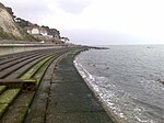
Steel Bay is a bay on the south-east coast of the Isle of Wight, England. It lies to the east of the village of Bonchurch. It faces south-east towards the English Channel and has a one-half-mile (0.80 km) shoreline. It stretches from Bordwood Ledge in the north to Dunnose headland in the south. The bay is remote and has no established access. It is best viewed from Dunnose which can be accessed by scrambling over The Landslip, which is close to the Isle of Wight Coastal Path in the woods to the east of Upper Bonchurch. The bay has a large intertidal reef with outlying rocks, which can be a danger for marine traffic. Situated beneath Bonchurch Landslips, part of the wider Undercliff landslide complex, the cliffs are highly unstable and prone to landslides. The cliffs consist of sandstones from the uppermost sections of the Lower Greensand group overlain by the Gault Clay, with superficial deposits of landslide debris including material from the Upper Greensand and Chalk. The coastline saw major landslide events in 1810, 1818 and to a lesser extent in February 1995. In 1871, the Underley, a 1,292-ton iron-hulled sailing ship, ran around in a strong gale at the point between Monk's Bay and Steel Bay. She was on a voyage from London to Melbourne with thirty passengers and cargo on board, the vessel was lost but all her passengers and crew were saved bar one – a steward re-boarded the ship to rescue his pet bird and was washed overboard as it broke apart. Fragments of the wreck can still be seen by divers in the area when a gale has shifted the sands.