Dunnose, Isle of Wight
Headlands of the Isle of Wight

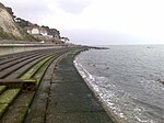
Dunnose is a cape on the Isle of Wight in the English Channel. The headland is visible from well out to sea, and is used in navigation. It has twice been used as the base point for a triangulation of Great Britain. The line of accurately surveyed points running north from Dunnose to Clifton in Yorkshire provide the basis for triangulation to determine the positions of all other locations in Britain.
Excerpt from the Wikipedia article Dunnose, Isle of Wight (License: CC BY-SA 3.0, Authors, Images).Dunnose, Isle of Wight
Newport Road,
Geographical coordinates (GPS) Address Website Nearby Places Show on map
Geographical coordinates (GPS)
| Latitude | Longitude |
|---|---|
| N 50.604965 ° | E -1.191094 ° |
Address
Ventnor Downs
Newport Road
PO38 1BD , Lowtherville
England, United Kingdom
Open on Google Maps


