place

Pine Creek Township, Clinton County, Pennsylvania

Pages with non-numeric formatnum argumentsPopulated places established in 1772Townships in Clinton County, PennsylvaniaTownships in PennsylvaniaUse mdy dates from July 2023
Appalachian Valley (1)

Pine Creek Township is a township in Clinton County, Pennsylvania, United States. The population was 3,394 at the 2020 census. The township is named for Pine Creek, which flows into the West Branch Susquehanna River at the border of the township with Lycoming County, between the boroughs of Avis and Jersey Shore

Excerpt from the Wikipedia article Pine Creek Township, Clinton County, Pennsylvania (License: CC BY-SA 3.0, Authors, Images).

Pine Creek Township, Clinton County, Pennsylvania
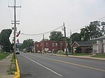
Gravel Hill Road, Pine Creek Township

Geographical coordinates (GPS) Address Nearby Places
placeShow on map

Wikipedia: Pine Creek Township, Clinton County, PennsylvaniaContinue reading on Wikipedia

Geographical coordinates (GPS)

Latitude Longitude
N 41.193333333333 ° E -77.345555555556 °
placeShow on map

Address

Gravel Hill Road 643
17745 Pine Creek Township
Pennsylvania, United States
mapOpen on Google Maps

Appalachian Valley (1)
Share experience

Nearby Places

Woolrich, Pennsylvania

Woolrich ( WUUL-ritch) is an unincorporated community in Pine Creek Township, Clinton County, Pennsylvania, United States. Its elevation is 725 feet (221 m), and it is located at 41°12′28″N 77°22′19″W (41.1911819, 77.3720595).Woolrich is a company town, the home of Woolrich, Inc., a family-owned clothing company. The company was founded in 1830 by John Rich and Daniel McCormick, and originally located at a mill on Little Plum Run in nearby Dunnstable Township. By 1834, Rich and McCormick decided to move their operations to a location with a better water supply at Chatham's Run in Pine Creek Township. They bought 300 acres and first built a sawmill; around 1845 the company (by then solely owned by John Rich) relocated to a new mill at the Chatham's Run location. This 1845 mill no longer exists in its original configuration, but its location remains the site of Woolrich's main operations and its surrounding community. The town was first called Factoryville, later Richville, and after 1888 was named Woolrich.John Rich began his business by selling wool to lumberjacks and their families who were located in the mountains of central Pennsylvania. The wool was used to make clothing and socks for the lumberjacks. Lumber was the primary source of income for most people who lived in this region. Hence the lumber barons' major homes in Williamsport, Pennsylvania called Millionaires Row. The woolen mill that was started was one of the businesses that sprang up to support the lumber industry. Woolrich Inc., though it does not make its clothes in the local factory, still manufactures blankets and fabric there, including those used in the U.S. military.In 2014 Woolrich Inc. partnered with a Delaware brewery, Dogfish Head to manufacture beer made from pine trees and introduced the black-and-red checkered pattern that is one of Woolrich's signature patterns in their logo.

Bald Eagle Mountain
Bald Eagle Mountain

Bald Eagle Mountain – once known locally as Muncy Mountain – is a stratigraphic ridge in the Ridge-and-Valley Appalachians of central Pennsylvania, United States, running east of the Allegheny Front and northwest of Mount Nittany. It lies along the southeast side of Bald Eagle Creek and south of the West Branch Susquehanna River, and is the westernmost ridge in its section of the Ridge-and-Valley Appalachians. The ridge line separates the West Branch Susquehanna Valley from the Nippenose and White Deer Hole valleys, and Bald Eagle Valley from Nittany Valley. Bald Eagle Mountain lies in the central portion of Centre County, the southern portion of Clinton County, and the southern portion of Lycoming County, and the ridge line forms part of the border between Blair County and Huntingdon County. It runs from the water gap formed with Brush Mountain by the Little Juniata River at Tyrone, to the bend in the West Branch Susquehanna River just east of Williamsport, a distance of approximately 60 miles (97 km). The Julian and Unionville Pikes are paved roads that cross the ridge near State College, along with U.S. Route 322 and Interstate 99 which pass through the now enlarged wind gap known as "Skytop". Most other major road crossings are through water gaps, including Interstate 80 which passes through Curtin Gap east of Milesburg. Other water gaps in the ridge are formed by Spring Creek on the south edge of Milesburg and by Fishing Creek at Mill Hall (where U.S. Route 220 crosses). U.S. Route 15 crosses through a wind gap south of Williamsport near Bald Eagle Mountain's eastern end. Bald Eagle Ridge is popular with soaring birds and glider pilots ridge soaring along its slopes. This ridge is part of a chain of ridges that stretch southwest to Tennessee. It is one of the best sites in the eastern United States for viewing the migration of the golden eagle. The Ridge Soaring Gliderport lies at the foot of this ridge between Julian and Unionville. A mature oak and hickory forest covers Bald Eagle Mountain.