place

McElhattan, Pennsylvania

Census-designated places in Clinton County, PennsylvaniaCensus-designated places in PennsylvaniaUse mdy dates from July 2023
Clinton County Pennsylvania incorporated and unincorporated areas McElhattan highlighted

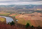
McElhattan is a census-designated place (CDP) in Wayne Township in southern Clinton County, Pennsylvania, United States. As of the 2010 census, the population was 598.The community is located in eastern Clinton County and is bordered to the northwest by the West Branch of the Susquehanna River and to the southeast by U.S. Route 220, a four-lane freeway. The southwestern part of the CDP includes the area known as Youngdale. US 220 leads west 6 miles (10 km) to the city of Lock Haven, the Clinton County seat, and northeast 7 miles (11 km) to the borough of Jersey Shore. Bridge Road crosses the West Branch, connecting McElhattan with Dunnstable Township to the northwest.

Excerpt from the Wikipedia article McElhattan, Pennsylvania (License: CC BY-SA 3.0, Authors, Images).

McElhattan, Pennsylvania
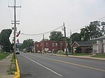
Linwood Drive, Wayne Township

Geographical coordinates (GPS) Address Nearby Places
placeShow on map

Wikipedia: McElhattan, PennsylvaniaContinue reading on Wikipedia

Geographical coordinates (GPS)

Latitude Longitude
N 41.159722222222 ° E -77.361388888889 °
placeShow on map

Address

Linwood Drive 8
17745 Wayne Township
Pennsylvania, United States
mapOpen on Google Maps

Clinton County Pennsylvania incorporated and unincorporated areas McElhattan highlighted
Share experience

Nearby Places

Bald Eagle Mountain
Bald Eagle Mountain

Bald Eagle Mountain – once known locally as Muncy Mountain – is a stratigraphic ridge in the Ridge-and-Valley Appalachians of central Pennsylvania, United States, running east of the Allegheny Front and northwest of Mount Nittany. It lies along the southeast side of Bald Eagle Creek and south of the West Branch Susquehanna River, and is the westernmost ridge in its section of the Ridge-and-Valley Appalachians. The ridge line separates the West Branch Susquehanna Valley from the Nippenose and White Deer Hole valleys, and Bald Eagle Valley from Nittany Valley. Bald Eagle Mountain lies in the central portion of Centre County, the southern portion of Clinton County, and the southern portion of Lycoming County, and the ridge line forms part of the border between Blair County and Huntingdon County. It runs from the water gap formed with Brush Mountain by the Little Juniata River at Tyrone, to the bend in the West Branch Susquehanna River just east of Williamsport, a distance of approximately 60 miles (97 km). The Julian and Unionville Pikes are paved roads that cross the ridge near State College, along with U.S. Route 322 and Interstate 99 which pass through the now enlarged wind gap known as "Skytop". Most other major road crossings are through water gaps, including Interstate 80 which passes through Curtin Gap east of Milesburg. Other water gaps in the ridge are formed by Spring Creek on the south edge of Milesburg and by Fishing Creek at Mill Hall (where U.S. Route 220 crosses). U.S. Route 15 crosses through a wind gap south of Williamsport near Bald Eagle Mountain's eastern end. Bald Eagle Ridge is popular with soaring birds and glider pilots ridge soaring along its slopes. This ridge is part of a chain of ridges that stretch southwest to Tennessee. It is one of the best sites in the eastern United States for viewing the migration of the golden eagle. The Ridge Soaring Gliderport lies at the foot of this ridge between Julian and Unionville. A mature oak and hickory forest covers Bald Eagle Mountain.

Woolrich, Pennsylvania

Woolrich ( WUUL-ritch) is an unincorporated community in Pine Creek Township, Clinton County, Pennsylvania, United States. Its elevation is 725 feet (221 m), and it is located at 41°12′28″N 77°22′19″W (41.1911819, 77.3720595).Woolrich is a company town, the home of Woolrich, Inc., a family-owned clothing company. The company was founded in 1830 by John Rich and Daniel McCormick, and originally located at a mill on Little Plum Run in nearby Dunnstable Township. By 1834, Rich and McCormick decided to move their operations to a location with a better water supply at Chatham's Run in Pine Creek Township. They bought 300 acres and first built a sawmill; around 1845 the company (by then solely owned by John Rich) relocated to a new mill at the Chatham's Run location. This 1845 mill no longer exists in its original configuration, but its location remains the site of Woolrich's main operations and its surrounding community. The town was first called Factoryville, later Richville, and after 1888 was named Woolrich.John Rich began his business by selling wool to lumberjacks and their families who were located in the mountains of central Pennsylvania. The wool was used to make clothing and socks for the lumberjacks. Lumber was the primary source of income for most people who lived in this region. Hence the lumber barons' major homes in Williamsport, Pennsylvania called Millionaires Row. The woolen mill that was started was one of the businesses that sprang up to support the lumber industry. Woolrich Inc., though it does not make its clothes in the local factory, still manufactures blankets and fabric there, including those used in the U.S. military.In 2014 Woolrich Inc. partnered with a Delaware brewery, Dogfish Head to manufacture beer made from pine trees and introduced the black-and-red checkered pattern that is one of Woolrich's signature patterns in their logo.

Memorial Park Site
Memorial Park Site

The Memorial Park Site (designated 36CN164) is an archaeological site located near the confluence of Bald Eagle Creek and the West Branch Susquehanna River in Lock Haven in the U.S. state of Pennsylvania. Research projects conducted at the site since 1979 have found prehistoric cultural deposits that collectively span 8,000 years.Stratified in age-related sequence, the deposits represent every major prehistoric period from the Middle Archaic to the Late Woodland. The site's dominant component holds the remains of an early Late Woodland (500–1000 CE) village inhabited by people of the Clemson Island culture. The convergent streams and their two valleys made the site readily accessible to pre-Columbian people living in both drainage basins. Among the components of the site are two strata, dating from 5000-6000 and c. 2600 BP respectively. Both components were radiocarbon dated from fragments of Cucurbita pepo, the squash plant; the absence of wild squash plants near the site and its distance from well-documented wild populations is evidence that the gourds were intentionally brought to the location by humans.Memorial Park contains the only area on the West Branch side of the point of land between the river and the creek that has not been disturbed by subsequent development. Alluvial deposits 20 to 28 inches (51 to 71 cm) deep cover the site and have protected it from recent activity on the surface. The Veterans of Foreign Wars acquired the property in the 1920s and used it for a park.Piper Aircraft bought the fields adjacent to the park in the 1960s to use for airport runways and airplane storage. In the 1970s, Conran A. Hay, a consultant, discovered the prehistoric site during an archeological survey conducted for the United States Army Corps of Engineers. Subsequent research sponsored by the Office of State Archeology and the Office of Historic Preservation of the Pennsylvania Historical and Museum Commission in 1980 helped determine the site boundaries.