Hudson River Historic District

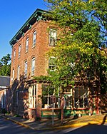
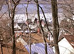
The Hudson River Historic District, also known as Hudson River Heritage Historic District, is the largest Federally designated district on the mainland of the contiguous United States. It covers an area of 22,205 acres (34.6 square miles, 89 km²) extending inland roughly a mile (1.6 km) from the east bank of the Hudson River between Staatsburg and Germantown in Dutchess and Columbia counties in the U.S. state of New York. This area includes the riverfront sections of the towns of Clermont, Red Hook, Rhinebeck and part of Hyde Park. This strip includes in their entirety the hamlets of Annandale, Barrytown, Rhinecliff and the village of Tivoli. Bard College and two protected areas, Margaret Lewis Norrie State Park and Tivoli Bays Unique Area, are also within the district. From the colonial era to the early 20th century, the district was characterized by large "country seats" built by members of the Livingston family, such as Clermont Manor and Montgomery Place, both National Historic Landmarks. For most of that period, these estates were worked by tenant farmers, with much of the rest of the population concentrated in small riverside communities. This semi-feudal arrangement is still reflected in land use and architecture within the district today, since it has not seen major development. In 1990, two separate historic districts were combined and expanded into a National Historic Landmark District (NHLD), in recognition of this unique history and character. Only 2% by acreage of the properties within the district are not considered historic.
Excerpt from the Wikipedia article Hudson River Historic District (License: CC BY-SA 3.0, Authors, Images).Hudson River Historic District
La Polt Avenue,
Geographical coordinates (GPS) Address Nearby Places Show on map
Geographical coordinates (GPS)
| Latitude | Longitude |
|---|---|
| N 41.920277777778 ° | E -73.936666666667 ° |
Address
La Polt Avenue 49
12572
New York, United States
Open on Google Maps


