Hope, Providence, Rhode Island
Neighborhoods in Providence, Rhode Island

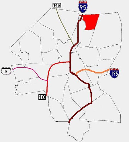
Hope is a neighborhood on the northern border of Providence, Rhode Island. To the west, it is bounded by North Main Street, the North Burial Ground, and Interstate 95, while Rochambeau Ave, Hope Street, and the Providence-Pawtucket city line roughly delineate its boundaries to the south, east, and north respectively. Hope is sometimes referred to as "Summit", named for the street that runs through the middle of the neighborhood. Though "Hope" is officially recognized, residents and the local neighborhood organization more often use "Summit".
Excerpt from the Wikipedia article Hope, Providence, Rhode Island (License: CC BY-SA 3.0, Authors, Images).Hope, Providence, Rhode Island
3rd Street, Providence
Geographical coordinates (GPS) Address Nearby Places Show on map
Geographical coordinates (GPS)
| Latitude | Longitude |
|---|---|
| N 41.85 ° | E -71.4 ° |
Address
3rd Street 59
02906 Providence
Rhode Island, United States
Open on Google Maps


