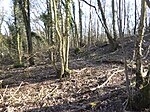
Bossingham
Hamlets in KentKent geography stubs
Bossingham is a large hamlet in the parish of Upper Hardres and the district of the City of Canterbury, Kent, England. It is located about five miles (8 km) south of Canterbury, and 2 miles (3.2 km) north of Stelling Minnis on a parallel road to the Roman road of Stone Street (the B2068 road). There is one public house – the Hop Pocket, named after the large sacks in which hops were transported. The nearest general store and post office are in Stelling Minnis.
Excerpt from the Wikipedia article Bossingham (License: CC BY-SA 3.0, Authors).Bossingham
Allée du Nord, Nanterre
Geographical coordinates (GPS) Address Nearby Places Show on map
Geographical coordinates (GPS)
| Latitude | Longitude |
|---|---|
| N 51.1996 ° | E 1.0772 ° |
Address
Allée du Nord
Allée du Nord
92400 Nanterre, Quartier du Faubourg de l'Arche
Île-de-France, France
Open on Google Maps


