place

Inchmoan

Argyll and Bute geography stubsIslands of Loch LomondScottish Site of Special Scientific Interest stubsSites of Special Scientific Interest in ScotlandUninhabited islands of Argyll and Bute
Ruined cottage on Inchmoan geograph.org.uk 1244200

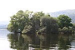
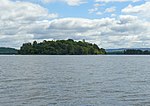
Inchmoan (Scottish Gaelic: Innis na Mòna or Innis-Mòine meaning 'peat island') is an island in Loch Lomond, Scotland.

Excerpt from the Wikipedia article Inchmoan (License: CC BY-SA 3.0, Authors, Images).

Geographical coordinates (GPS)

Latitude Longitude
N 56.066666666667 ° E -4.6 °
placeShow on map

Address

Balloch


G83 8LE
Scotland, United Kingdom
mapOpen on Google Maps

Ruined cottage on Inchmoan geograph.org.uk 1244200
Share experience

Nearby Places

Loch Lomond
Loch Lomond

Loch Lomond (; Scottish Gaelic: Loch Laomainn - 'Lake of the Elms') is a freshwater Scottish loch which crosses the Highland Boundary Fault, often considered the boundary between the lowlands of Central Scotland and the Highlands. Traditionally forming part of the boundary between the counties of Stirlingshire and Dunbartonshire, Loch Lomond is split between the council areas of Stirling, Argyll and Bute and West Dunbartonshire. Its southern shores are about 23 kilometres (14 mi) northwest of the centre of Glasgow, Scotland's largest city. The Loch forms part of the Loch Lomond and The Trossachs National Park which was established in 2002. Loch Lomond is 36.4 kilometres (22.6 mi) long and between 1 and 8 kilometres (0.62–4.97 mi) wide, with a surface area of 71 km2 (27.5 sq mi). It is the largest lake in Great Britain by surface area; in the United Kingdom, it is surpassed only by Lough Neagh and Lough Erne in Northern Ireland. In the British Isles as a whole there are several larger loughs in the Republic of Ireland. The loch has a maximum depth of about 190 metres (620 ft) in the deeper northern portion, although the southern part of the loch rarely exceeds 30 metres (98 ft) in depth. The total volume of Loch Lomond is 2.6 km3 (0.62 cu mi), making it the second largest lake in Great Britain, after Loch Ness, by water volume.The loch contains many islands, including Inchmurrin, the largest fresh-water island in the British Isles. Loch Lomond is a popular leisure destination and is featured in the song "The Bonnie Banks o' Loch Lomond". The loch is surrounded by hills, including Ben Lomond on the eastern shore, which is 974 metres (3,196 ft) in height and the most southerly of the Scottish Munro peaks. A 2005 poll of Radio Times readers voted Loch Lomond as the sixth greatest natural wonder in Britain.

River Leven, Dunbartonshire

The River Leven (Uisge Leamhna in Gaelic) is a stretch of water in West Dunbartonshire, Scotland, flowing from Loch Lomond in the North to the River Clyde in the South. The river is about 6 miles (10 kilometres) long. It is very popular with salmon and sea trout anglers, trying to catch one of these migratory fish going up to Loch Lomond. The Vale of Leven is a collection of communities in the northern part of the river, whilst the town of Dumbarton sits at the southern end. Dumbarton Castle sits at the confluence of the river with the Clyde. The Leven is a relatively short river but is widely claimed to be the second fastest flowing river in Scotland, after the River Spey. Possibly because of this, or possibly because it passes through a built-up area, it has a reputation as a dangerous river with many drownings over the years. The Linnbrane Hole in Alexandria is reputed to be the most dangerous spot. The river is crossed by nine bridges and two weirs. There is a path for pedestrians and cyclists near the river, which connects with a cycle path to Glasgow. It follows the river very closely from Balloch to Renton, less closely from Renton to Dumbarton. The river includes two large meander bends, at Cordale and Dalquhurn. In the past the river was used to get steamers into Loch Lomond, although they sometimes did not find it an easy journey and could have difficulty getting past the bridges. Nowadays the river is considered to be not navigable. The height of the river can vary, sometimes being a good deal higher in winter than summer.