place

Ellanderroch

Islands of Loch LomondScotland geography stubsUninhabited islands of Stirling (council area)
Innisnacailleach
Innisnacailleach

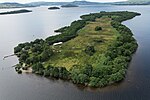
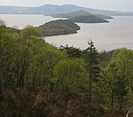
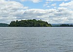
Ellanderroch (Scottish Gaelic: Eilean Darach/Eilean nan Darach meaning "oak island") is an island in Loch Lomond in Scotland. It is a very small island, 100 metres in breadth at its widest point. It lies a short distance to the south-west of the larger island of Inchfad. The island has been used as a shelter for fishermen. There are many oaks left on the small island; a hollow one was filled in with concrete, but was struck by lightning, and now only the concrete remains.

Excerpt from the Wikipedia article Ellanderroch (License: CC BY-SA 3.0, Authors, Images).

Ellanderroch
Low Path,

Geographical coordinates (GPS) Address Nearby Places
placeShow on map

Wikipedia: EllanderrochContinue reading on Wikipedia

Geographical coordinates (GPS)

Latitude Longitude
N 56.079444444444 ° E -4.5811111111111 °
placeShow on map

Address

Low Path
G63 0JS
Scotland, United Kingdom
mapOpen on Google Maps

Innisnacailleach
Innisnacailleach
Share experience

Nearby Places

Loch Lomond
Loch Lomond

Loch Lomond (; Scottish Gaelic: Loch Laomainn - 'Lake of the Elms') is a freshwater Scottish loch which crosses the Highland Boundary Fault, often considered the boundary between the lowlands of Central Scotland and the Highlands. Traditionally forming part of the boundary between the counties of Stirlingshire and Dunbartonshire, Loch Lomond is split between the council areas of Stirling, Argyll and Bute and West Dunbartonshire. Its southern shores are about 23 kilometres (14 mi) northwest of the centre of Glasgow, Scotland's largest city. The Loch forms part of the Loch Lomond and The Trossachs National Park which was established in 2002. Loch Lomond is 36.4 kilometres (22.6 mi) long and between 1 and 8 kilometres (0.62–4.97 mi) wide, with a surface area of 71 km2 (27.5 sq mi). It is the largest lake in Great Britain by surface area; in the United Kingdom, it is surpassed only by Lough Neagh and Lough Erne in Northern Ireland. In the British Isles as a whole there are several larger loughs in the Republic of Ireland. The loch has a maximum depth of about 190 metres (620 ft) in the deeper northern portion, although the southern part of the loch rarely exceeds 30 metres (98 ft) in depth. The total volume of Loch Lomond is 2.6 km3 (0.62 cu mi), making it the second largest lake in Great Britain, after Loch Ness, by water volume.The loch contains many islands, including Inchmurrin, the largest fresh-water island in the British Isles. Loch Lomond is a popular leisure destination and is featured in the song "The Bonnie Banks o' Loch Lomond". The loch is surrounded by hills, including Ben Lomond on the eastern shore, which is 974 metres (3,196 ft) in height and the most southerly of the Scottish Munro peaks. A 2005 poll of Radio Times readers voted Loch Lomond as the sixth greatest natural wonder in Britain.

Loch Lomond National Nature Reserve

Loch Lomond National Nature Reserve (NNR) (Scottish Gaelic: Tèarmann Nàdair Nàiseanta Loch Laomainn) encompasses 430 hectares of land at the southeastern part of Loch Lomond in the council areas of Stirling and West Dunbartonshire, in Scotland. It covers the islands of Inchcailloch, Clairinsh, Torrinch, Creinch and Aber Isle, alongside areas of woodland and wetlands to either side of the mouth of the Endrick Water. NatureScot owns two parts of the reserve - the island of Inchcailloch and part of Gartfairn Wood - and the rest is privately owned. The reserve is managed by a partnership consisting of NatureScot, the RSPB Scotland and the Loch Lomond and The Trossachs National Park, along with the owners and tenants of the land under agreements. Within this framework NatureScot directly manage the islands of Clairinsh, Inchcailloch, Torrinch and Creinch, and land to the north of the Endrick Water. The RSPB manages the area to the south of the Endrick Water, and the national park manages visitor facilities on Inchcailloch.The first part of Loch Lomond to be declared a national nature reserve was Clairinsh in 1958; the reserve was subsequently extended three times to reach its present size. The reserve encompasses a wide range of habitats, including woodlands, open water, grassland and wetlands. Due to its position on the Highland Boundary Fault, the varying natural environments of the highlands and lowlands give rise to habitats and species at both their northern and southern limit. Prior to becoming an NNR, the land was used for farming, producing woodland and to a lesser degree, for recreation. Some of these practices are still used, but now with a stronger focus on wildlife practices and maintaining the diversity of the area.