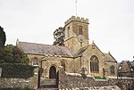
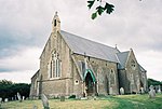
Atrim
Dorset geography stubsOpenDomesdayVillages in Dorset
Atrim is a small village in Dorset, England, just north of the large town, Bridport. It is situated on the River Simene. The nearest village is Dottery, closely followed by the larger village of Salway Ash. Atrim is made up of a few houses, and is very near the famous Monarch's Way.
Excerpt from the Wikipedia article Atrim (License: CC BY-SA 3.0, Authors).Atrim
Broadoak Road,
Geographical coordinates (GPS) Address Nearby Places Show on map
Geographical coordinates (GPS)
| Latitude | Longitude |
|---|---|
| N 50.75 ° | E -2.79 ° |
Address
Broadoak Road
Broadoak Road
DT6 6HJ , Symondsbury
England, United Kingdom
Open on Google Maps


