Hatherton, Cheshire

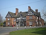
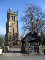
Hatherton is a hamlet and civil parish in the unitary authority of Cheshire East and the ceremonial county of Cheshire, England. The hamlet is on the B5071 at SJ687474, 2+3⁄4 miles (4.4 km) to the north east of Audlem and 3+3⁄4 miles (6.0 km) to the south east of Nantwich. The civil parish has an area of 673 hectares (1,660 acres) and also includes the small settlements of Birchall Moss, Broomlands and part of Artlebrook, with a total population of 360 in 2011. Nearby villages include Hankelow, Stapeley, Walgherton, Wybunbury, Blakenhall and Buerton. The A529 runs through the parish and the River Weaver forms the western boundary. Hatherton was first recorded in the Domesday survey as Haretone. The 18th-century Hatherton Manor farmhouse is listed at grade II*, and there are also grade-II-listed timber-framed and brick farmhouses and former country houses. The hamlet has a Methodist chapel. The Hatherton Flush Site of Special Scientific Interest is a wetland by the Weaver that supports marsh helleborine, marsh lousewort and tubular water-dropwort, which are rare in Cheshire.
Excerpt from the Wikipedia article Hatherton, Cheshire (License: CC BY-SA 3.0, Authors, Images).Hatherton, Cheshire
Hatherton Road,
Geographical coordinates (GPS) Address Nearby Places Show on map
Geographical coordinates (GPS)
| Latitude | Longitude |
|---|---|
| N 53.022 ° | E -2.468 ° |
Address
Hatherton Road (Crewe Road)
Hatherton Road
CW5 7QY
England, United Kingdom
Open on Google Maps


