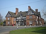
Stapeley
Borough of Cheshire EastEngvarB from July 2016Former civil parishes in CheshireVillages in Cheshire

Stapeley is a hamlet (at SJ675496) and former civil parish, now in the parish of Stapeley and District, in the unitary authority area of Cheshire East and the ceremonial county of Cheshire, England. The hamlet lies 2¼ miles to the south east of Nantwich. The parish also included the small settlements of Broad Lane and Butt Green, and parts of Artle Brook, Haymoor Green and Howbeck Bank, as well as a recent residential development north of the A5301 adjacent to Nantwich. In 2008, the total population was estimated to be a little under 3000, increasing to 3,336 at the 2011 Census. Nearby villages include Shavington, Willaston and Wybunbury.
Excerpt from the Wikipedia article Stapeley (License: CC BY-SA 3.0, Authors, Images).Stapeley
Second Dig Lane,
Geographical coordinates (GPS) Address Nearby Places Show on map
Geographical coordinates (GPS)
| Latitude | Longitude |
|---|---|
| N 53.043 ° | E -2.484 ° |
Address
Second Dig Lane
Second Dig Lane
CW5 7JZ , Stapeley and District
England, United Kingdom
Open on Google Maps


