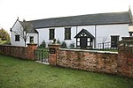
Calveley
Borough of Cheshire EastFormer civil parishes in CheshireVillages in Cheshire

Calveley is a village and former civil parish, now in the parish of Alpraham and Calveley, in the unitary authority area of Cheshire East and the ceremonial county of Cheshire, England. The village lies 5½ miles to the north west of Nantwich. The parish also includes parts of the settlements of Barrets Green and Wardle Bank. The total population is 280 people. The area is largely agricultural and includes a short stretch of the Shropshire Union Canal. There is an Anglican parish church, a primary school and a public house. Nearby villages include Alpraham, Bunbury, Haughton and Wardle. In 2011 the parish had a population of 280.
Excerpt from the Wikipedia article Calveley (License: CC BY-SA 3.0, Authors, Images).Calveley
Nantwich Road,
Geographical coordinates (GPS) Address Nearby Places Show on map
Geographical coordinates (GPS)
| Latitude | Longitude |
|---|---|
| N 53.125 ° | E -2.612 ° |
Address
Nantwich Road
Nantwich Road
CW6 9JL , Alpraham and Calveley
England, United Kingdom
Open on Google Maps


