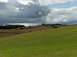
East Meon
EngvarB from June 2016Villages in Hampshire

East Meon is a village and civil parish in the East Hampshire district of Hampshire, England. It is 4.4 miles (7.1 km) west of Petersfield. The village is located in the Meon Valley approximately 31 km (19 mi) north of Portsmouth and 98 km (61 mi) southwest of London, on the headwaters of the River Meon. The parish has an area of 11,370 acres (46.0 km2). The boundaries of the present parish of East Meon date back to 1894. About a mile to the west rises the prominent hill of Henwood Down (201 m). The South Downs Way passes over the southern spur of the hill. Petersfield railway station is the nearest station, 4 miles (6.4 km) east of the village.
Excerpt from the Wikipedia article East Meon (License: CC BY-SA 3.0, Authors, Images).East Meon
Hill View, East Hampshire East Meon
Geographical coordinates (GPS) Address Nearby Places Show on map
Geographical coordinates (GPS)
| Latitude | Longitude |
|---|---|
| N 50.994 ° | E -1.033 ° |
Address
Hill View
Hill View
GU32 1NS East Hampshire, East Meon
England, United Kingdom
Open on Google Maps


