place

Kent Downs

Areas of Outstanding Natural Beauty in EnglandChalk landformsHills of KentKent geography stubsProtected areas of Kent
DownsRanscombeFieldToMway0734c

The Kent Downs is an Area of Outstanding Natural Beauty (AONB) in Kent, England. They are the eastern half of the North Downs and stretch from the London/Surrey borders to the White Cliffs of Dover, including a small section of the London Borough of Bromley. The AONB also includes the Greensand Ridge, a prominent sandstone escarpment which lies south of the chalk escarpment of the North Downs. It was first designated as an AONB in July 1968 and covers 878 square km (326 square miles). The AONB's highest point is Toy's Hill, at 250m above sea level, and its boundaries include three main rivers: the Darent, Medway and Stour.To the west, Surrey Hills AONB adjoins the Kent Downs AONB, and includes a continuation of the North Downs chalk ridge which runs through the Kent Downs, stretching from Farnham to the English Channel and reappearing within the Parc Naturel Régional des Caps et Marais d’Opale in France. High Weald AONB lies to the south east, separated by a distance of just over 2km at Bough Beech Reservoir. As part of the management of the AONB, Village Design Statements have been adopted by 14 per cent of villages within its boundaries, going on to form part of Supplementary Planning Guidance, recognising the character of the historic landscape and distinctiveness of settlements.

Excerpt from the Wikipedia article Kent Downs (License: CC BY-SA 3.0, Authors, Images).

Kent Downs
Pilgrims Way,

Geographical coordinates (GPS) Address Nearby Places
placeShow on map

Wikipedia: Kent DownsContinue reading on Wikipedia

Geographical coordinates (GPS)

Latitude Longitude
N 51.29 ° E 0.58 °
placeShow on map

Address

Pilgrims Way

Pilgrims Way
ME14 3LD , Thurnham
England, United Kingdom
mapOpen on Google Maps

DownsRanscombeFieldToMway0734c
Share experience

Nearby Places

St Martin of Tours Church, Detling

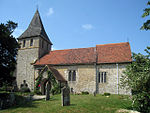
St Martin of Tours is a parish church in Detling, Kent. Dedicated to Martin of Tours, the building was constructed in the 12th century with 13th and 15th-century additions and restoration carried out in the late 19th century. It is a Grade I listed building. The nave and chancel are of early Norman construction and built of flint with a plain tiled roof. The aisle to the north of the nave is Early English and is constructed of flint and local rag-stone. It was enlarged in the 1880s. The adjacent chapel on the north side of the chancel and the porch on the south side of the nave are Perpendicular Gothic. The tower is built in two stages of galletted rag-stone with diagonal corner buttresses. The timber-shingled broach spire was added in 1861 by R. C. Hussey. The roof structure to the chapel is original, but the rest of the roof was replaced in the 19th century.The church windows are of varying sizes and periods although mostly perpendicular in style. Over the doorway on the west side of the tower is a large rectangular three-lighted perpendicular window added in the 19th century. The windows to the nave, aisle and chapel are mainly two-lighted in design. Those to the south-east and east of the chancel and three-lighted. Internally, the nave and aisle are separated by a pair of wide plain arches and the chancel and chapel by a single arch.The large twelve-sided font is early and plain and stands on a 20th-century base, having once been built into the wall of the tower. An ornately carved four-sided oak lectern dates from 1340–50. It probably came from Boxley Abbey and has been described as "the finest medieval fitting in any parish church in the county". The church's pipe organ dates from the 1850s and was brought from the Congregational Church in Maidstone in 1973, and was installed and to a large part funded by long time organist, Colin Savage, from East Court, Detling.The churchyard contains a headstone and a table tomb that are Grade II listed.