place

Great Herring Pond

Bourne, MassachusettsPlymouth County, Massachusetts geography stubsPonds of Barnstable County, MassachusettsPonds of Plymouth, Massachusetts
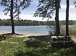
Great Herring Pond, Cedarville MA

Great Herring Pond is a 376-acre (1.5 km2) warm water pond mostly located in Plymouth, Massachusetts, with the southern portion extending into Bourne. The village of Pondville in the Cedarville section of Plymouth lies on the eastern shore of the pond. The pond has an average depth of 20 ft (6 m) and a maximum depth of 42 ft (13 m). The bottom is composed of sand, rubble and muck. A tire reef was installed in 1979 to provide additional fish shelter. The inflow comes from Little Herring Pond, and the outflow goes into the Herring River in Bourne. The Public Access Board gravel ramp in Bourne enters shallow water and is therefore best suited for canoes, inflatable and other shallow-draft, hand-carried craft. There have been multiple sightings of massive turtles on Great Herring Pond, 4–5 feet (1.2–1.5 m) long, floating downstream from Little Herring Pond under Carters Bridge.In colonial days, a large village of Christian Indians lived nearby in a place called Comassekumkanet, which means "on the other side of the prince's house" in Algonquin. Thomas Tupper, an early settler, preached to them though he was not ordained.

Excerpt from the Wikipedia article Great Herring Pond (License: CC BY-SA 3.0, Authors, Images).

Great Herring Pond
Valley Road, Plymouth

Geographical coordinates (GPS) Address Nearby Places
placeShow on map

Wikipedia: Great Herring PondContinue reading on Wikipedia

Geographical coordinates (GPS)

Latitude Longitude
N 41.8075 ° E -70.564722222222 °
placeShow on map

Address

Camp Bournedale

Valley Road
02560 Plymouth
Massachusetts, United States
mapOpen on Google Maps

Great Herring Pond, Cedarville MA
Share experience

Nearby Places

Hedges Pond
Hedges Pond

Hedges Pond is a 26-acre (110,000 m2) pond in the Cedarville section of Plymouth, Massachusetts with access from Hedges Pond Rd. The pond is located more than one mile (1.6 km) north of Cedarville's business district past the Route 3 underpass, southeast of Black Jimmy Pond (Hyles Pond), and east of Little Herring Pond. Hedges Pond has no private residences on its shores. Camp Dennen once occupied the eastern shore of the pond. The 30-acre (12 ha) camp, formerly owned by The Episcopal Diocese of Massachusetts was acquired by the Town of Plymouth with Community Preservation Act Funds along with 60 acres (24 ha) of land along the western shore of the pond in 2008. After studying the best way to provide recreational uses, the town opened Hedges Pond Recreational Area and Preserve on July 16, 2011, having completed phase 1 which includes a lifeguarded sandy beach, a bathhouse, picnic areas, a small playground and walking trails. There will also be an area for launching small non-motorized boats.Further development is expected to provide tennis, basketball, open fields, extended beaches and picnic areas, and more extensive trails. Rehabilitation of five existing cabins is expected to enable overnight stays to accommodate a revenue-generating eight-week summer day camp. During the weeks that the day camp is in operation the park would only be open to the public on weekends.Hedges Pond was named after an American Indian, Will Hedge, the original owner of the town site.