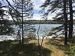
Long Pond (Plymouth, Massachusetts)
Ponds of MassachusettsPonds of Plymouth, MassachusettsUse mdy dates from July 2023Villages in MassachusettsVillages in Plymouth, Massachusetts

Long Pond is a 211-acre (0.85 km2) cold water pond in Plymouth, Massachusetts, east of Myles Standish State Forest, Halfway Pond and Round Pond, west of Route 3 at Exit 3 and The Pinehills, northwest of Bloody Pond, and north of West Wind Shores. The pond has an average depth of 46 feet (14 m) and a maximum depth of 100 feet (30 m). It is fed by groundwater and an inlet from Little Long Pond, and drains through the pond bottom. A paved boat ramp provided by the Public Access Board with ample parking spaces is easily accessible from Route 3. The Pond has a 50 hp limitation on boating.
Excerpt from the Wikipedia article Long Pond (Plymouth, Massachusetts) (License: CC BY-SA 3.0, Authors, Images).Long Pond (Plymouth, Massachusetts)
Cornish Field Road, Plymouth
Geographical coordinates (GPS) Address Nearby Places Show on map
Geographical coordinates (GPS)
| Latitude | Longitude |
|---|---|
| N 41.858333333333 ° | E -70.604166666667 ° |
Address
Cornish Field Road 62
Plymouth
Massachusetts, United States
Open on Google Maps


