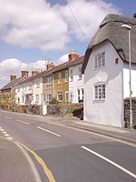
Blunsdon
Borough of SwindonCivil parishes in WiltshireOpenDomesdayUse British English from September 2013

Blunsdon is a civil parish in the Borough of Swindon, in Wiltshire, England, about 4 miles (6 km) north of the centre of Swindon, with the A419 forming its southern boundary. Its main settlement is the village of Broad Blunsdon, with Lower Blunsdon nearby; the hamlet of Broadbush is now contiguous with Broad Blunsdon. Blunsdon is the eastern half of the former Blunsdon St Andrew civil parish. In April 2017, that parish was divided and the western half became a new St Andrews parish.
Excerpt from the Wikipedia article Blunsdon (License: CC BY-SA 3.0, Authors, Images).Blunsdon
Ermin Street,
Geographical coordinates (GPS) Address Nearby Places Show on map
Geographical coordinates (GPS)
| Latitude | Longitude |
|---|---|
| N 51.61 ° | E -1.79 ° |
Address
Ermin Street
Ermin Street
SN26 8AA , Blunsdon
England, United Kingdom
Open on Google Maps


