place

Whitehouse Station, New Jersey

Census-designated places in Hunterdon County, New JerseyCensus-designated places in New JerseyUnincorporated communities in Readington Township, New JerseyUse American English from June 2023Use mdy dates from June 2023
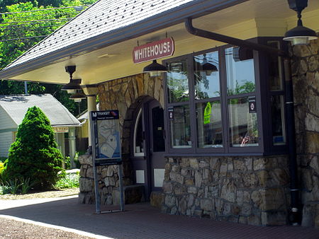
Whitehouse Station
Whitehouse Station

Whitehouse Station, also spelled White House Station, is an unincorporated community and census-designated place (CDP) located within Readington Township, in Hunterdon County, New Jersey. At the 2010 United States Census, the CDP's population was 2,089. Whitehouse Station takes its name from Whitehouse and Abraham Van Horne's 18th century tavern.New Jersey Transit offers service on the Raritan Valley Line at White House Station.

Excerpt from the Wikipedia article Whitehouse Station, New Jersey (License: CC BY-SA 3.0, Authors, Images).

Whitehouse Station, New Jersey
Main Street,

Geographical coordinates (GPS) Address Nearby Places
placeShow on map

Wikipedia: Whitehouse Station, New JerseyContinue reading on Wikipedia

Geographical coordinates (GPS)

Latitude Longitude
N 40.615277777778 ° E -74.770555555556 °
placeShow on map

Address

The Rail At Readington

Main Street 157
08889
New Jersey, United States
mapOpen on Google Maps

Whitehouse Station
Whitehouse Station
Share experience

Nearby Places

Readington Township, New Jersey

Readington Township is a township located in the easternmost portion of Hunterdon County, in the U.S. state of New Jersey. As of the 2020 United States census, the township's population was 16,128, an increase of two people (+0.0%) from the 2010 census count of 16,126, which in turn reflected an increase of 323 (+2.0%) from the 15,803 counted in the 2000 census.Created by Royal charter of King George II, "Reading" Township was formed on July 15, 1730, from portions of Amwell Township. It was the first new township created after Hunterdon was established as an independent county. The township was incorporated as Readingtown Township, one of New Jersey's initial group of 104 townships, on February 21, 1798. Portions of the township were annexed by Tewksbury Township in 1832 and 1861. The township was named for John Reading, the first native-born governor of the British Province of New Jersey.Covering more than 48 square miles (120 km2), it is the largest township in the county, covering almost 11% of the county's area. More than 8,000 acres (32 km2) of land have been preserved from development. Readington Township is bounded on the north by the Lamington River and Rockaway Creek; to the east by Somerset County, which existed as the boundary between East and West Jersey from 1688 to 1695; to the south, the South Branch of the Raritan River; and to the west by the old West Jersey Society's line which crosses the Cushetunk Mountains.