Bramling
Kent geography stubsUse British English from May 2020Villages in Kent

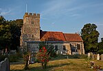
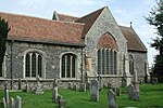
Bramling is a hamlet five miles (8 km) east of Canterbury in Kent, England. It lies on the A257 road between Littlebourne and Wingham. The local public house is called The Haywain. The population of the hamlet taken at the 2011 Census was included in the civil parish of Ickham and Well
Excerpt from the Wikipedia article Bramling (License: CC BY-SA 3.0, Authors, Images).Bramling
Bramling Road, Canterbury Ickham and Well
Geographical coordinates (GPS) Address Nearby Places Show on map
Geographical coordinates (GPS)
| Latitude | Longitude |
|---|---|
| N 51.266 ° | E 1.191 ° |
Address
Bramling Road
Bramling Road
CT3 1NB Canterbury, Ickham and Well
England, United Kingdom
Open on Google Maps


