Missoula, Montana

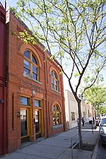
Missoula ( mih-ZOO-lə; Séliš: Nłʔay, lit. 'Place of the Small Bull Trout'; Kutenai: Tuhuⱡnana) is a city in and the county seat of Missoula County, Montana, United States. It is located along the Clark Fork River near its confluence with the Bitterroot and Blackfoot Rivers in western Montana and at the convergence of five mountain ranges, thus it is often described as the "hub of five valleys". The 2020 United States Census shows the city's population at 73,489 and the population of the Missoula Metropolitan Area at 117,922. After Billings, Missoula is the second-largest city and metropolitan area in Montana. Missoula is home to the University of Montana, a public research university. The Missoula area began seeing settlement by people of European descent in 1858 including William T. Hamilton, who set up a trading post along the Rattlesnake Creek, Captain Richard Grant, who settled near Grant Creek, and David Pattee, who settled near Pattee Canyon. Missoula was founded in 1860 as Hellgate Trading Post while still part of Washington Territory. By 1866, the settlement had moved east, 5 miles (8 km) upstream, and had been renamed Missoula Mills, later shortened to Missoula. The mills provided supplies to western settlers traveling along the Mullan Road. The establishment of Fort Missoula in 1877 to protect settlers further stabilized the economy. The arrival of the Northern Pacific Railway in 1883 brought rapid growth and the maturation of the local lumber industry. In 1893, the Montana Legislature chose Missoula as the site for the state's first university. Along with the U.S. Forest Service headquarters founded in 1908, lumber and the university remained the basis of the local economy for the next 100 years.By the 1990s, Missoula's lumber industry had gradually disappeared, and as of 2009, the city's largest employers were the University of Montana, Missoula County Public Schools, and Missoula's two hospitals. The city is governed by a mayor–council government with 12 city council members, two from each of the six wards. In and around Missoula are 400 acres (160 ha) of parkland, 22 miles (35 km) of trails, and nearly 5,000 acres (2,000 ha) of open-space conservation land, with adjacent Mount Jumbo being home to grazing elk and mule deer during the winter. The city is also home to both of Montana's largest and its oldest active breweries, as well as the Montana Grizzlies. Notable residents include the first woman to serve in the U.S. Congress, Jeannette Rankin.
Excerpt from the Wikipedia article Missoula, Montana (License: CC BY-SA 3.0, Authors, Images).Missoula, Montana
Klosterhof, Solingen Gräfrath
Geographical coordinates (GPS) Address Phone number Website Nearby Places Show on map
 Continue reading on Wikipedia
 Geographical coordinates (GPS)
| Latitude | Longitude |
|---|---|
| N 46.8625 ° | E -114.01166666667 ° |
Address
Deutsches Klingenmuseum
Klosterhof 4
42653 Solingen, Gräfrath
Nordrhein-Westfalen, Deutschland
Open on Google Maps
Phone number
Website
klingenmuseum.de