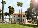
Be'er Tuvia Regional Council

Be'er Tuvia Regional Council (Hebrew: מועצה אזורית באר טוביה, Mo'atza Azorit Be'er Tovia), is a regional council in the Southern District of Israel. It borders Yoav and Nahal Sorek regional councils in the east; Hof Ashkelon regional council, the Mediterranean Sea, the city of Ashdod and Gan Yavne local council in the west; Gederot, Hevel Yavne regional councils and Gedera, Bnei Aish local councils in the north; Shafir regional council in the south. The town of Kiryat Malakhi is enclaved in the middle. Be'er Tuvia was incorporated as a regional council in 1950, with a land-area of approximately 140,000 dunams (140 km²). According to the Israel Central Bureau of Statistics, the regional council had a population of 18,600.
Excerpt from the Wikipedia article Be'er Tuvia Regional Council (License: CC BY-SA 3.0, Authors, Images).Be'er Tuvia Regional Council
HaHadarim, Beer Tuvia Regional Council
Geographical coordinates (GPS) Address Nearby Places Show on map
Geographical coordinates (GPS)
| Latitude | Longitude |
|---|---|
| N 31.766666666667 ° | E 34.716666666667 ° |
Address
HaHadarim
6094600 Beer Tuvia Regional Council
South District, Israel
Open on Google Maps


