Salehurst

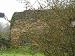
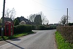
Salehurst is a village in the Rother district of East Sussex, England, within the civil parish of Salehurst and Robertsbridge. It lies immediately to the north-east of the larger village of Robertsbridge, on a minor road; it is approximately thirteen miles (21 km) north of Hastings, just east of the A21 road. In historical terms Salehurst is much older than its neighbour; before the bridge over the River Rother was built it already existed, and it is named in the Domesday Book. At the time the river crossing was by ford or ferry, but in the 12th century a newly established order of Cistercian monks constructed the bridge, and the two settlements of Robertsbridge and Northbridge Street came into being; eventually - since the main road now bypassed the village - becoming much more important than Salehurst.Salehurst lies approximately three miles from Bodiam, Sussex, site of Bodiam Castle. One owner of Bodiam Castle was the Levett family, who lived at Salehurst during their 'occupation' of the castle. In 1588 John Levett of Salehurst contributed to the Armada loan, and in 1607 his sons John and Thomas of Salehurst were regranted by the College of Arms their right to the Levett coat of arms issued to their Sussex ancestors.John Colepeper, 1st Baron Colepeper (ca.1600–1660) was an English peer, military officer and politician who, as Chancellor of the Exchequer (1642–43) and Master of the Rolls (1643) was an influential counsellor of King Charles I during the English Civil War. His family came from Wigsell in the parish of Salehurst.
Excerpt from the Wikipedia article Salehurst (License: CC BY-SA 3.0, Authors, Images).Salehurst
Robertsbridge Bypass, Rother Salehurst and Robertsbridge
Geographical coordinates (GPS) Address Nearby Places Show on map
Geographical coordinates (GPS)
| Latitude | Longitude |
|---|---|
| N 50.99 ° | E 0.48 ° |
Address
Robertsbridge Bypass
Robertsbridge Bypass
TN32 5PG Rother, Salehurst and Robertsbridge
England, United Kingdom
Open on Google Maps


