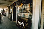
Old Town, Croydon
Districts of the London Borough of CroydonLondon geography stubsUse British English from November 2022

Old Town is a neighbourhood in the London Borough of Croydon, lying immediately to the west of Croydon town centre. It is centred on Croydon Minster and the Old Palace, and is the location of the original early medieval settlement of Croydon. As defined for modern planning purposes, the neighbourhood includes Surrey Street Market to the east, and extends west as far as the boundaries of Wandle Park, and south to Croydon Flyover (part of the east-west A232 road). It is bisected by the dual-carriageway north-south A236, known along this stretch as Roman Way. It is in the CR0 postcode area.
Excerpt from the Wikipedia article Old Town, Croydon (License: CC BY-SA 3.0, Authors, Images).Old Town, Croydon
Old Palace Road, London Broad Green (London Borough of Croydon)
Geographical coordinates (GPS) Address Phone number Website Nearby Places Show on map
Geographical coordinates (GPS)
| Latitude | Longitude |
|---|---|
| N 51.373 ° | E -0.105 ° |
Address
Old Palace of John Whitgift School
Old Palace Road 1
CR0 1AX London, Broad Green (London Borough of Croydon)
England, United Kingdom
Open on Google Maps


