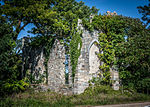
place

Wye House

Archaeological sites on the National Register of Historic Places in MarylandFrederick DouglassHistoric American Buildings Survey in MarylandHouses completed in 1781Houses in Talbot County, Maryland
Houses on the National Register of Historic Places in MarylandLloyd family of MarylandNational Historic Landmarks in MarylandNational Register of Historic Places in Talbot County, MarylandPlantation houses in MarylandUse mdy dates from August 2023Welsh-American culture in MarylandWelsh-American history
Wye House, view of front, HABS

Wye House is a historic residence and former headquarters of a historic plantation house northwest of Easton in rural Talbot County, Maryland. Built in 1781–1784, it is a high-quality and well-proportioned example of a wooden-frame Southern plantation house. It was designated a National Historic Landmark in 1970.

Excerpt from the Wikipedia article Wye House (License: CC BY-SA 3.0, Authors, Images).

Wye House
Bruffs Island Road, Easton

Geographical coordinates (GPS) Address External links Nearby Places
placeShow on map

Wikipedia: Wye HouseContinue reading on Wikipedia

Geographical coordinates (GPS)

Latitude Longitude
N 38.853398 ° E -76.168406 °
placeShow on map

Address

Wye House

Bruffs Island Road
Easton
Maryland, United States
mapOpen on Google Maps

linkWikiData (Q8039706)
linkOpenStreetMap (465967157)

Wye House, view of front, HABS
Share experience

Nearby Places

Unionville, Talbot County, Maryland

Unionville is an unincorporated community in Talbot County, Maryland, United States. Unionville is located on Maryland Route 370, 4.5 miles (7.2 km) northwest of Easton. In Unionville, a historic marker reads: “Unionville: Historic African-American community settled by ex-slaves and free blacks. Many were in [the] Union Army in [the] Civil War; [the] village's name honors [these] local soldiers. Unionville grew after the war to nearly 40 buildings with [a] church and school. In [the] cemetery are 18 black soldiers who fought for the Union 1863-66.” The formation of Unionville is widely credited to Ezekiel and his son James M. Cowgill, Quakers who owned nearby Lombardy Plantation. In 1856, they carved out a parcel of land for these veterans described in the sign. Another of Ezekiel's sons, John Cowgill, who was also a Quaker, served as Captain in Company A, 108th Regiment U.S. Colored Infantry, Army of the Cumberland even though he was a Quaker. The reasons why are not widely known. The Cowgills offered each of the eighteen veterans a plot of land for the rate of one dollar a year for thirty years. The land records show that the Cowgills intended not only to offer land for families but land to build a town. They stipulated in their leases that the plot of land was offered to free African-Americans provided that they would build a church and a school house in their community. Starting in 1867, the first leases variously state that the land was at “Lombardy” or sometimes “Cowgillstown,” but from 1870 onwards the leases read “The Village of Unionville”. Thus the village today is known as “Unionville” in honor of the Union Army that the African-Americans credit with winning their freedom. “Cowgillstown” also stands as a tribute to Ezekiel, John and James M. Cowgill, who championed the cause for justice, freedom, dignity, better living conditions and community for African-Americans during the Civil War and after Emancipation.

Wye River (Maryland)

The Wye River is a 16.3-mile-long (26.2 km) tributary of the Chesapeake Bay, on the Eastern Shore of Maryland. It was named by the Lloyd family, Edward Lloyd (delegate), and Edward Lloyd (Governor of Maryland), after the River Wye in the United Kingdom. It falls within Queen Anne's County and Talbot County, and joins the Miles River near its mouth to the Eastern Bay. The river is popular with recreational boaters because of its secluded anchorages, fishing, crabbing and proximity to the tourist attractions of St. Michaels, Maryland. Like many rivers on the Chesapeake Bay, the Wye is largely tidal. The river's features include the 2,800-acre (11 km2) Wye Island, most of which is part of the Wye Island Natural Resources Management Area, managed by the Maryland Department of Natural Resources State Forest and Park Service. William Paca, the third governor of Maryland and a signatory to the Declaration of Independence, once owned the island. The nearby Aspen Institute Wye River Conference Centers (sections of which were formerly known as the "Wye River plantation") hosted the 1998 Mideast Peace talks attended by Israeli Prime Minister Benjamin Netanyahu and Palestinian Authority Chairman Yasser Arafat, and hosted by US President Bill Clinton that culminated in the Wye River Memorandum. The watershed also includes the Wye Research and Education Center, operated by the University of Maryland College of Agriculture and Natural Resources, Maryland Agricultural Experiment Station (MAES). They conduct agricultural research and education, in cooperation with the nearby Aspen Institute Wye River Conference Centers. Elián González and his father stayed at the Wye River Plantation briefly in 2000.Water quality is threatened by development.