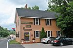
Ten Mile River (Housatonic River tributary)
Connecticut geography stubsHudson Valley, New York geography stubsNew York (state) river stubsNortheastern United States river stubsRivers of Connecticut ... and 4 more
Rivers of Dutchess County, New YorkRivers of Litchfield County, ConnecticutRivers of New York (state)Tributaries of Housatonic River

The Ten Mile River (Tenmile River on federal maps) is a 15.4-mile-long (24.8 km) river that flows through Dutchess County, New York, into westernmost Connecticut. The river is formed in the town of Amenia, New York, at the confluence of Webatuck Creek and Wassaic Creek. The Ten Mile River runs south through the town of Dover, New York before turning east and crossing into Connecticut, where it forms the boundary between the towns of Kent and Sherman for one-half mile before flowing into the Housatonic River. This is a popular whitewater paddling destination with mostly quickwater and a few whitewater areas reaching up to Class III.
Excerpt from the Wikipedia article Ten Mile River (Housatonic River tributary) (License: CC BY-SA 3.0, Authors, Images).Ten Mile River (Housatonic River tributary)
Kent Road,
Geographical coordinates (GPS) Address Nearby Places Show on map
Geographical coordinates (GPS)
| Latitude | Longitude |
|---|---|
| N 41.6659 ° | E -73.5068 ° |
Address
Ten Mile River Lean-to
Kent Road
06776
Connecticut, United States
Open on Google Maps


