Guderhandviertel
AC with 0 elementsLüneburg region geography stubsMunicipalities in Lower SaxonyStade (district)

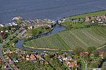
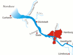
Guderhandviertel is a municipality in the district of Stade, Lower Saxony, Germany. It belonged to the Prince-Archbishopric of Bremen. In 1648 the Prince-Archbishopric was transformed into the Duchy of Bremen, which was first ruled in personal union by the Swedish and from 1715 on by the Hanoverian Crown. In 1823 the Duchy was abolished and its territory became part of the Stade Region.
Excerpt from the Wikipedia article Guderhandviertel (License: CC BY-SA 3.0, Authors, Images).Guderhandviertel
Hohenfelde, Samtgemeinde Lühe
Geographical coordinates (GPS) Address Nearby Places Show on map
Geographical coordinates (GPS)
| Latitude | Longitude |
|---|---|
| N 53.55 ° | E 9.6166666666667 ° |
Address
Hohenfelde 77a
21720 Samtgemeinde Lühe
Lower Saxony, Germany
Open on Google Maps


