Elizabeth Vale
Adelaide geography stubsSuburbs of AdelaideUse Australian English from August 2019

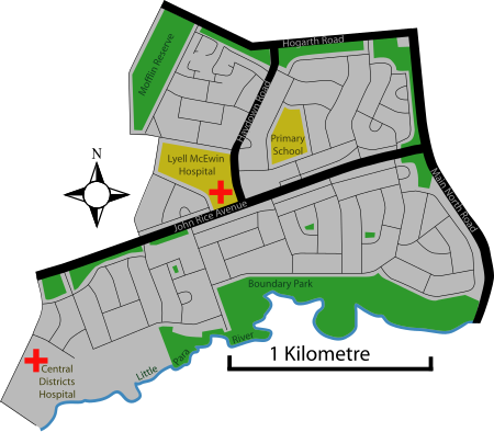
Elizabeth Vale is a suburb in the northern extent of Adelaide, South Australia. It was established in 1955. Its main roads are Main North Road to the east and John Rice Avenue which bisects the suburb. The southern boundary is the northern bank of the Little Para River. Elizabeth Vale has two hospitals, the Lyell McEwin Hospital, a public teaching hospital, and the private Central Districts Hospital.
Excerpt from the Wikipedia article Elizabeth Vale (License: CC BY-SA 3.0, Authors, Images).Elizabeth Vale
Mark Road, Adelaide Elizabeth South
Geographical coordinates (GPS) Address Nearby Places Show on map
Geographical coordinates (GPS)
| Latitude | Longitude |
|---|---|
| N -34.749 ° | E 138.661 ° |
Address
Mark Road
Mark Road
5112 Adelaide, Elizabeth South
South Australia, Australia
Open on Google Maps


