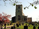
Langtoft, Lincolnshire
Civil parishes in LincolnshireSouth Kesteven DistrictUse British English from January 2014Villages in Lincolnshire

Langtoft is a village and civil parish in the South Kesteven district of Lincolnshire, England. The population of the civil parish at the 2021 census was 2,008. It lies on the A15 road, about 10 miles (16 km) north from Peterborough and about 8 miles (13 km) east from Stamford, and on the edge of The Fens. Langtoft falls within the drainage area of the Welland and Deepings Internal Drainage Board.
Excerpt from the Wikipedia article Langtoft, Lincolnshire (License: CC BY-SA 3.0, Authors, Images).Langtoft, Lincolnshire
Bourne Road, South Kesteven Langtoft
Geographical coordinates (GPS) Address Nearby Places Show on map
Geographical coordinates (GPS)
| Latitude | Longitude |
|---|---|
| N 52.699631 ° | E -0.34113 ° |
Address
Bourne Road
Bourne Road
PE6 9NJ South Kesteven, Langtoft
England, United Kingdom
Open on Google Maps


