Westerveld
Drenthe geography stubsMunicipalities of DrentheMunicipalities of the Netherlands established in 1998Pages including recorded pronunciationsPages with Dutch IPA ... and 1 more
Westerveld

Westerveld (Dutch pronunciation: [ˌʋɛstərˈvɛlt] ) is a municipality in the northeastern Netherlands. The municipality Westerveld was established in 1998 out of the municipalities of Diever, Dwingeloo, Havelte, and Vledder. Westerveld is crossed by a channel, the Drentsche Hoofdvaart. There are also two National Parks situated in the municipality, the Drents-Friese Wold and Dwingelerveld.
Excerpt from the Wikipedia article Westerveld (License: CC BY-SA 3.0, Authors, Images).Westerveld
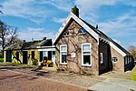
Haarweg, Westerveld
Geographical coordinates (GPS) Address Nearby Places Show on map
Geographical coordinates (GPS)
| Latitude | Longitude |
|---|---|
| N 52.866666666667 ° | E 6.3166666666667 ° |
Address
Haarweg
Haarweg
7981 LH Westerveld
Drenthe, Netherlands
Open on Google Maps


