place

Thurton

Civil parishes in NorfolkNorfolk geography stubsVillages in Norfolk
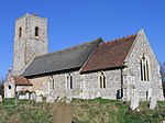
St Ethelbert, Thurton, Norfolk geograph.org.uk 1281043

Thurton is a village in South Norfolk lying 8½ miles (13½ km) south-east of Norwich on the A146 Norwich to Lowestoft road between Framingham Pigot and Loddon. The A146 effectively divides the village in two; a 40 mph limit is in force. At the 2001 census and the 2011 Census Thurton had 223 households and a population of 567.Thurton is written 'Tortuna' in the Domesday Book. The suffix is the Anglo-Saxon 'tun', meaning an enclosed space. The prefix may refer to a thorn bush, or perhaps to the Anglo-Saxon god Thunor, whom the Normans called Thur. So Thurton may mean 'the place of the thorn bush' or 'Thor's enclosure'. The village no longer has a shop, post office or garage, all having closed. It has a pub, the George and Dragon which has darts and pool teams and sponsors the football team. It also provides the focus for the village's annual St George's Day celebrations and is often host to local bands. Opposite the pub is Thurton Foundry which was founded in 1963 and produces ferrous and non-ferrous castings. The village hosts a large classic car show and autojumble annually which raises significant money for local charities. The thatched parish church stands on a hill to the south of the village and is dedicated to St Ethelbert. Parts date from the Norman period. Thurton Primary School has around 90 children between the ages of 4–11.

Excerpt from the Wikipedia article Thurton (License: CC BY-SA 3.0, Authors, Images).

Thurton
The Meadows, South Norfolk

Geographical coordinates (GPS) Address Nearby Places
placeShow on map

Wikipedia: ThurtonContinue reading on Wikipedia

Geographical coordinates (GPS)

Latitude Longitude
N 52.557 ° E 1.435 °
placeShow on map

Address

The Meadows

The Meadows
NR14 6BB South Norfolk
England, United Kingdom
mapOpen on Google Maps

St Ethelbert, Thurton, Norfolk geograph.org.uk 1281043
Share experience

Nearby Places

Claxton, Norfolk
Claxton, Norfolk

Claxton is a small village 8.5 miles (13.7 km) south-east of Norwich, and south of the River Yare, between Rockland St. Mary and Loddon in South Norfolk, England. In the 2001 census it contained 85 households and a population of 244, the population increasing to 291 at the 2011 census. Just to the south lie the small villages of Ashby St Mary and Carleton St Peter. The villages name origin is uncertain but possibly means 'Clacc's farm/settlement', 'Klakkr's farm/settlement' or perhaps, 'hill farm/settlement'. To the east of the village are the remains of Claxton Castle, which dates from the mid-14th century, licences to crenellate having been granted in 1340 and 1376. Situated on private land in the grounds of Claxton Manor House it comprises a massive brick-and-flint wall 130 feet (40 m) long with six bastions. Claxton Manor House itself was built in the reign of Elizabeth I but has a Victorian façade. The Manor was bought in 1946 by Major Derek Allhusen, who achieved fame as a horseman winning team gold and individual silver at the 1968 Summer Olympics. Derek Allhusen died in 2000.To the south-west of the village lies Claxton Church. It is thought that the Saxon settlement which would have been built around it moved down to the marsh edge in the Middle Ages. The church has a thatched scissor-beam roof with basketweave sarking. The flint tower is unbuttressed and dates from the 14th century, though much restored. Between 1926 and 1936 a narrow gauge railway ran the 1 mile (1.6 km) from Claxton Manor Farm in the village north to the south bank of the River Yare. In 1928 it was extended south to Staines Barn, just east of the church. It was used to transport sugar beet bound for the factory at Cantley which was loaded onto wherries at the river. It used 2-foot (610 mm) gauge jubilee track and a converted Model T Ford as motive power.A windmill once stood at the eastern end of the village on Mill Lane. It was demolished in 1945 as it was thought to be a landmark for enemy aircraft. A Spitfire crash-landed in Claxton Marsh to the north of the village in the same year and is now on display at the Norfolk and Suffolk Aviation Museum. Claxton no longer has a pub (closed 1974), post office (closed 1977) or school (closed 1981), although a combined shop and petrol station survived until 2002. It does have a village hall, Claxton Village Hall is shared with Carleton St Peter. The current hall was opened in 1984 and is home to a social club founded in 1987 and licensed for the sale of alcohol. Claxton is served by bus route 85 operated by Our Bus providing three services a day into Norwich via Rockland St Mary, Bramerton and Kirby Bedon. It also lies on National Cycle Route 1 on its route from Norwich to Beccles via Loddon. Claxton has a Strict and Particular Baptist chapel erected in the 1750s and could hold 500 in its heyday, but finally closed for worship in 1943. Claxton Opera staged occasional performances in the Old Meeting House from 2004 to 2013.It is now a private home. South of the village on the banks of Carleton Beck lies Ducan's Marsh, a Site of Special Scientific Interest and one of the richest areas of unimproved wet grassland in East Norfolk.

Mundham
Mundham

Mundham, historically Mundaham or Mundhala, is a small village and civil parish in the county of Norfolk, England. Archaeological and toponymic evidence of Mundham's existence predates its appearance in the Domesday survey of 1086, dating back to c.130 AD in the late Pax Romana period, however, it was not called Mundham until sometime between the 5th and 7th centuries, although there has been consistent activity in the area since the early Neolithic period. In the 2011 census, the population was 177 in 64 households, however in the 2021 census, the population had dropped to 147, in 67 households. The parish covers an area of 6.31 km2 (2.44 sq mi), and is approximately 9.1 miles (14.6 km) southeast of Norwich and 13.5 miles (21.7 km) west of Great Yarmouth. For the purposes of local government, it falls within the district of South Norfolk, however Mundham does have a parish council responsible for local matters laid down by law, including a role in local planning, it consists of five councillors, and a clerk. The village contains a number of heritage-listed buildings, which include a 12th-century church, multiple farmhouses, and the ruins of a 13th-century church. The fields and woodland surrounding Mundham have changed little in the past 500 years, and the village itself remains rural with a low population density compared to the national average.Mundham is located in the electoral district of Loddon, which is part of the South Norfolk district of the county of Norfolk, England. Near the centre of Mundham, there is a small stream which flows into the River Chet. Mundham borders the River Chet to the north, between Mundham and Bergh Apton, and is located 11 miles southeast of Norwich. In the west, it borders Seething, while in the northeast, it borders Sisland. In the southeast the extensions of Loddon reach. In the south Mundham borders Thwaite, and in the southwest it borders with Hedenham. The village sign is located near St Peter's Church, and depicts a series of houses in the foreground, with St Peter's church and the millennium oak in the background, the sign's supports are carved into a sheath of wheat, with a small mouse and a poppy hidden within them.

Langley Hall
Langley Hall

Langley Hall is a red-brick building in the Palladian style, formerly a country house but now a private school, located near Loddon, Norfolk, England. It is a grade I listed building.The house was built in the Palladian style of nearby Holkham Hall, though much smaller: a large principal central block linked to two flanking secondary wings by short corridors. It was later enlarged with the addition of corner turrets by George Proctor and wings by Sir William Beauchamp-Proctor, and addition of a Doric portico in the 19th century. The interior of the Hall boasts fine plaster decorations in the library attributed to the court sculptor of Frederick V of Denmark, Charles Stanley. The fine ceiling in the ladies' boudoir, on 'Music and Entertainment', was painted by Andien de Clermont prior to his return to France in 1755. The Hall was originally built c.1730 for Richard Berney, on 25 hectares (60 acres) of land that until the Dissolution of the Monasteries belonged to Langley Abbey. It was sold a few years later to George Proctor, who commissioned Matthew Brettingham to remodel the building. In 1744, the estate was inherited by Proctor's nephew, William Beauchamp who, in compliance with his uncle's will, changed his name to Beauchamp-Proctor and who was created a baronet the following year. The family later changed their name to Proctor-Beauchamp. He completed the building work and employed Lancelot Brown to advise on the landscaping. In 1785 new entrance lodges were built to the design of architect John Soane. The estate remained in the Proctor-Beauchamp family until the 20th century. During the second world war the house was occupied by the army and the pasture land ploughed. After the war the house and grounds were bought by Langley School, an independent boarding and day school, and the lodges separately sold.