Freckenham
Civil parishes in SuffolkForest HeathVillages in Suffolk

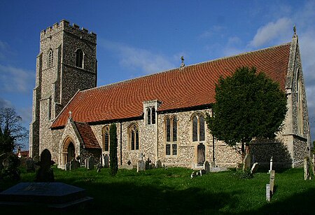
Freckenham is a small rural village and civil parish in the West Suffolk district of Suffolk in East Anglia, in the country of England. Geographically, it is relatively flat and has the River Kennet, a tributary of the River Lark locally known as the Lee Brook, cutting through the centre of the village. The parish's boundary forms, on its west and south sides, the boundary between Cambridgeshire and Suffolk. The village's name is listed as "Frekeham" in 895, and appears in the Domesday Book of 1086 as "Frakenaham". The name is believed to mean "homestead of a man called Freca", or derive from frecena a Saxon word meaning "the home of strong men or warriors".
Excerpt from the Wikipedia article Freckenham (License: CC BY-SA 3.0, Authors, Images).Freckenham
Fordham Road, West Suffolk
Geographical coordinates (GPS) Address Nearby Places Show on map
Geographical coordinates (GPS)
| Latitude | Longitude |
|---|---|
| N 52.3167 ° | E 0.433 ° |
Address
Fordham Road
Fordham Road
IP28 8JB West Suffolk
England, United Kingdom
Open on Google Maps


