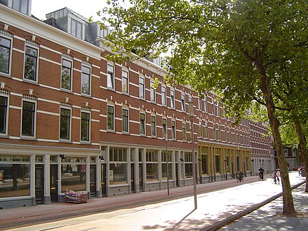
Katendrecht
AC with 0 elementsFormer municipalities of South HollandNeighbourhoods of RotterdamSouth Holland geography stubs

Katendrecht is a former village in the Dutch province of South Holland. It is now a neighbourhood of Rotterdam, on the south bank of the Nieuwe Maas. Nowadays it is the name of the peninsula which lies between the Rijnhaven and the Maashaven. Katendrecht was a separate municipality between 1817 and 1874, when it merged with Charlois. The neighbourhood covers an area of 1,18 km² with 4,760 inhabitants. In the twentieth century it was the most well known and even famous red light district of Rotterdam with many entertainment venues for sailors. The neighborhood's nickname is De Kaap.
Excerpt from the Wikipedia article Katendrecht (License: CC BY-SA 3.0, Authors, Images).Katendrecht
Brede Hilledijk, Rotterdam Feijenoord
Geographical coordinates (GPS) Address Website Nearby Places Show on map
Geographical coordinates (GPS)
| Latitude | Longitude |
|---|---|
| N 51.9 ° | E 4.4833333333333 ° |
Address
Amazing Oriental
Brede Hilledijk
3072 NK Rotterdam, Feijenoord
South Holland, Netherlands
Open on Google Maps


