place

Mattapoisett, Massachusetts

Mattapoisett, MassachusettsPopulated coastal places in MassachusettsPopulated places established in 1750Towns in MassachusettsTowns in Plymouth County, Massachusetts
Use mdy dates from January 2023
20210611 Ned Point Light 2

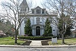
Mattapoisett is a town in Plymouth County, Massachusetts. The population was 6,508 at the 2020 census. Mattapoisett Center is located in the town. Mattapoisett is a part of the South Coast region of Massachusetts which encompasses the cities and towns that surround Buzzards Bay (excluding the Elizabeth Islands, Bourne and Falmouth), Mount Hope Bay and the Sakonnet River.

Excerpt from the Wikipedia article Mattapoisett, Massachusetts (License: CC BY-SA 3.0, Authors, Images).

Mattapoisett, Massachusetts
Main Street,

Geographical coordinates (GPS) Address Nearby Places
placeShow on map

Wikipedia: Mattapoisett, MassachusettsContinue reading on Wikipedia

Geographical coordinates (GPS)

Latitude Longitude
N 41.658333333333 ° E -70.816666666667 °
placeShow on map

Address

Main Street 13
02739
Massachusetts, United States
mapOpen on Google Maps

20210611 Ned Point Light 2
Share experience

Nearby Places

Ned Point Light
Ned Point Light

Ned Point Light is a historic lighthouse on Ned's Point Road in Mattapoisett, Massachusetts. The lighthouse was built in 1838 at a cost of approximately $5,000, and named after Ned Dexter, a local farmer. Under the supervision of a local builder, Leonard Hammond, the lighthouse was constructed with a birdcage-style lantern similar to Bird Island Light found in Marion, Massachusetts. The stone used for the lighthouse was all locally sourced, with most of it originating from nearby beaches. Inside, there are 32 granite steps that are cantilevered to the outside wall without the use of mortar. The original lantern used 11 whale oil lamps, each with its own parabolic reflector. The lamps and reflectors were replaced by a fifth order Fresnel lens in 1857, along with a change to an octagonal lantern. The Great Blizzard of 1888 significantly damaged the keeper's stone house, resulting in it being demolished and the building of a wooden replacement. Following the lighthouse's automation in 1923, the keeper's house became unnecessary. The original stone keeper's house was loaded on a barge and taken to Wing's Neck Light in Bourne, Massachusetts. The lighthouse was deactivated from 1952, but remained under control of the US Coast Guard. Following modernization in 1961, the lighthouse was reactivated in 1961 with its current 6-second isophase. The lighthouse was added to the National Register of Historic Places in 1982, and approved in 1988.