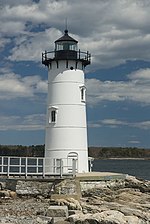
Kittery Point, Maine
Census-designated places in MaineCensus-designated places in York County, MaineKittery, MainePopulated coastal places in MainePortland metropolitan area, Maine

Kittery Point is a census-designated place (CDP) in the town of Kittery, York County, Maine, United States. First settled in 1623, Kittery Point traces its history to the first seafarers who colonized the shore of what became Massachusetts Bay Colony and later the State of Maine. Located beside the Atlantic Ocean, it is home to Fort McClary State Historic Site, and Fort Foster Park on Gerrish Island. Cutts Island is home to Seapoint Beach and the Brave Boat Harbor Division of the Rachel Carson National Wildlife Refuge. Kittery Point is part of the Portland–South Portland–Biddeford, Maine Metropolitan Statistical Area. The population was 1,012 at the 2010 census.
Excerpt from the Wikipedia article Kittery Point, Maine (License: CC BY-SA 3.0, Authors, Images).Kittery Point, Maine
School Lane,
Geographical coordinates (GPS) Address Website Nearby Places Show on map
Geographical coordinates (GPS)
| Latitude | Longitude |
|---|---|
| N 43.085277777778 ° | E -70.701666666667 ° |
Address
School Lane 7
03905
Maine, United States
Open on Google Maps


